Area Overview for TN17 4JE
Photos of TN17 4JE
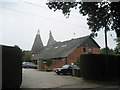

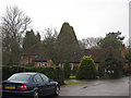
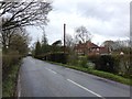
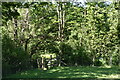
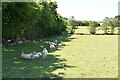
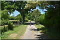
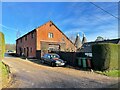
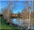
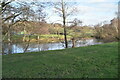
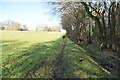
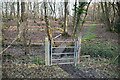
54 photos from this area
Area Information
Key information about the TN17 4JE including its size, population, and administrative classification.
- Area Type
- Postcode
- Area Size
- 43.2 hectares
- Population
- 1417
- Population Density
- 90 people/km²
House Prices in TN17 4JE
21
Properties
£649,429
Average Sold Price
£245,000
Lowest Price
£1,435,000
Highest Price
Showing 21 properties
| Address | Type | Beds | Baths | Last Sale Price | Last Sale Date | |
|---|---|---|---|---|---|---|
| The Coach House, Benenden Road, Rolvenden, TN17 4JE | Bungalow | - | - | £485,000 | Sep 2021 | |
| The Oak, Benenden Road, Rolvenden, TN17 4JE | Bungalow | - | - | £490,000 | Nov 2015 | |
| Chessenden Cottage, Benenden Road, Rolvenden, TN17 4JE | Bungalow | - | - | £1,435,000 | Jul 2013 | |
| Ranters Hall, Benenden Road, Rolvenden, TN17 4JE | house | - | - | £908,000 | Aug 2011 | |
| Crabtree, Benenden Road, Rolvenden, TN17 4JE | Semi-detached | 3 | 2 | £457,000 | May 2008 | |
| Little Ranters Oast, Benenden Road, Rolvenden, TN17 4JE | Detached | 4 | 2 | £526,000 | Nov 2007 | |
| Pond Cottage, Benenden Road, Rolvenden, TN17 4JE | Bungalow | - | - | £245,000 | Dec 2005 | |
| Chessenden, Benenden Road, Rolvenden, TN17 4JE | Detached | 6 | 3 | - | - | |
| Pooh Corner, Benenden Road, Rolvenden, TN17 4JE | Farm | 4 | 2 | - | - | |
| Tennis 28M From The Coach House, Benenden Road 16M From B2086, Benenden Road, Rolvenden, TN17 4JE | Leisure | - | - | - | - |
Page 1 of 3
Energy Efficiency in TN17 4JE
Amenities
Schools
| Rank | School | Type | Entry gender | Ages |
|---|
Explore more schools in this area
Go to Schools tabDemographics
Household Size
Two person
most common
Accommodation Type
Houses
most common
Tenure
66
majority
Ethnic Group
White
most common
Religion
N/A
most common
Household Composition
N/A
most common
Age
47
median
Adults (30-64 years)
most common
Household Deprivation
N/A
with no deprivation
NS-SEC
37
in Lower managerial occupations
Explore more demographic insights in this area
Go to Demographics tabPlanning
Planning Constraints
- Flood RiskPremium
- Ramsar Wetland SitesPremium
- Area of Outstanding Natural BeautyPremium
- Protected Nature ReservePremium
- Protected WoodlandPremium