Area Overview for TN17 3QX
Photos of TN17 3QX
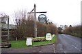
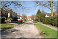
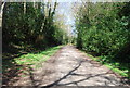
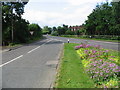
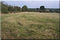
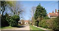
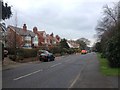
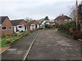
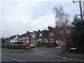
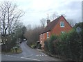
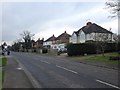
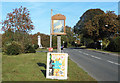
30 photos from this area
Area Information
Key information about the TN17 3QX including its size, population, and administrative classification.
- Area Type
- Postcode
- Area Size
- 4.1 hectares
- Population
- 1239
- Population Density
- 69 people/km²
House Prices in TN17 3QX
20
Properties
£593,911
Average Sold Price
£5,000
Lowest Price
£1,332,750
Highest Price
Showing 20 properties
| Address | Type | Beds | Baths | Last Sale Price | Last Sale Date | |
|---|---|---|---|---|---|---|
| Vectis, Hartley Road, Cranbrook, TN17 3QX | Semi-detached | 4 | 2 | £450,000 | Sep 2025 | |
| Oak Lodge, Hartley Road, Cranbrook, TN17 3QX | house | 6 | 3 | £1,300,000 | Aug 2023 | |
| The Slatings, Hartley Road, Cranbrook, TN17 3QX | Detached | 4 | 2 | £620,000 | May 2023 | |
| Hartley Mount, Hartley Road, Cranbrook, TN17 3QX | Detached | 8 | 6 | £1,332,750 | Aug 2022 | |
| Hedgeways, Hartley Road, Cranbrook, TN17 3QX | Detached | 3 | 3 | £5,000 | May 2022 | |
| Broadoak, Hartley Road, Cranbrook, TN17 3QX | house | 5 | - | £975,000 | Feb 2022 | |
| High Timbers, Hartley Road, Cranbrook, TN17 3QX | Detached | 3 | 1 | £525,000 | Jun 2021 | |
| The Old Nursery, Hartley Road, Cranbrook, TN17 3QX | house | - | - | £650,000 | Jun 2021 | |
| Birch Tree Cottage, Hartley Road, Cranbrook, TN17 3QX | Detached | 5 | 3 | £505,000 | Jan 2020 | |
| Hartley Villa, Hartley Road, Cranbrook, TN17 3QX | house | - | - | £435,000 | Nov 2015 |
Page 1 of 2
Energy Efficiency in TN17 3QX
Amenities
Schools
| Rank | School | Type | Entry gender | Ages |
|---|
Explore more schools in this area
Go to Schools tabDemographics
Household Size
Two person
most common
Accommodation Type
Houses
most common
Tenure
76
majority
Ethnic Group
White
most common
Religion
N/A
most common
Household Composition
N/A
most common
Age
47
median
Adults (30-64 years)
most common
Household Deprivation
N/A
with no deprivation
NS-SEC
42
in Lower managerial occupations
Explore more demographic insights in this area
Go to Demographics tabPlanning
Planning Constraints
- Flood RiskPremium
- Ramsar Wetland SitesPremium
- Area of Outstanding Natural BeautyPremium
- Protected Nature ReservePremium
- Protected WoodlandPremium