Area Overview for TN17 2AB
Photos of TN17 2AB
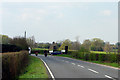
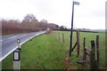
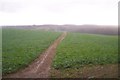
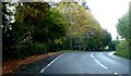
27 photos from this area
Area Information
Key information about the TN17 2AB including its size, population, and administrative classification.
- Area Type
- Postcode
- Area Size
- 2.0 km²
- Population
- 2327
- Population Density
- 80 people/km²
House Prices in TN17 2AB
28
Properties
£699,000
Average Sold Price
£295,000
Lowest Price
£1,235,000
Highest Price
Showing 28 properties
| Address | Type | Beds | Baths | Last Sale Price | Last Sale Date | |
|---|---|---|---|---|---|---|
| Little Summer, Biddenden Road, Sissinghurst, Cranbrook, TN17 2AB | Semi-detached | 2 | 1 | £365,000 | Jul 2023 | |
| Roundshill, Biddenden Road, Sissinghurst, Cranbrook, TN17 2AB | Detached | 5 | 3 | £901,000 | Nov 2019 | |
| Forest Edge, Biddenden Road, Sissinghurst, Cranbrook, TN17 2AB | Detached | 4 | - | £1,235,000 | Mar 2017 | |
| Castle Mead, Biddenden Road, Sissinghurst, Cranbrook, TN17 2AB | Detached | 4 | 2 | £295,000 | Apr 2003 | |
| Branden Cottage, Biddenden Road, Sissinghurst, Cranbrook, TN17 2AB | house | 4 | 3 | - | - | |
| 2, Little Branden, Biddenden Road, Sissinghurst, Cranbrook, TN17 2AB | house | 3 | 2 | - | - | |
| The Hop Garden, Biddenden Road, Sissinghurst, Cranbrook, TN17 2AB | Detached | - | - | - | - | |
| Branden, Biddenden Road, Sissinghurst, Cranbrook, TN17 2AB | house | 7 | - | - | - | |
| Aragon Farm, Biddenden Road, Sissinghurst, Cranbrook, TN17 2AB | Detached | - | - | - | - | |
| 1, Little Branden, Biddenden Road, Sissinghurst, Cranbrook, TN17 2AB | house | - | - | - | - |
Page 1 of 3
Energy Efficiency in TN17 2AB
Amenities
Schools
| Rank | School | Type | Entry gender | Ages |
|---|
Explore more schools in this area
Go to Schools tabDemographics
Household Size
Two person
most common
Accommodation Type
Houses
most common
Tenure
76
majority
Ethnic Group
White
most common
Religion
N/A
most common
Household Composition
N/A
most common
Age
47
median
Adults (30-64 years)
most common
Household Deprivation
N/A
with no deprivation
NS-SEC
45
in Lower managerial occupations
Explore more demographic insights in this area
Go to Demographics tabPlanning
Planning Constraints
- Flood RiskPremium
- Ramsar Wetland SitesPremium
- Area of Outstanding Natural BeautyPremium
- Protected Nature ReservePremium
- Protected WoodlandPremium