Area Overview for TN17 1HA
Photos of TN17 1HA
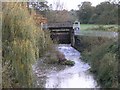
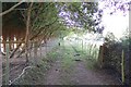

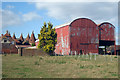
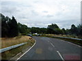
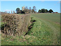
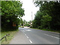
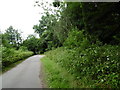
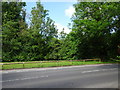
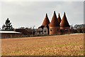
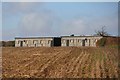
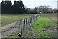
73 photos from this area
Area Information
Key information about the TN17 1HA including its size, population, and administrative classification.
- Area Type
- Postcode
- Area Size
- 31.1 hectares
- Population
- 1406
- Population Density
- 55 people/km²
House Prices in TN17 1HA
13
Properties
£561,889
Average Sold Price
£163,000
Lowest Price
£1,425,000
Highest Price
Showing 13 properties
| Address | Type | Beds | Baths | Last Sale Price | Last Sale Date | |
|---|---|---|---|---|---|---|
| Whistle Halt Cottage, Station Road, Goudhurst, Cranbrook, TN17 1HA | Semi-detached | 4 | 3 | £630,000 | Aug 2025 | |
| Green Cross Cottage, Station Road, Goudhurst, Cranbrook, TN17 1HA | Semi-detached | 5 | 3 | £685,000 | Mar 2025 | |
| Greensleeves, Station Road, Goudhurst, Cranbrook, TN17 1HA | Retail | 4 | - | £493,500 | Sep 2022 | |
| Mulberry House, Station Road, Goudhurst, Cranbrook, TN17 1HA | Detached | - | - | £1,425,000 | Oct 2016 | |
| Station Villa, Station Road, Goudhurst, Cranbrook, TN17 1HA | Semi-detached | 2 | 2 | £279,000 | Jun 2015 | |
| Hope Mill Oast, Station Road, Goudhurst, Cranbrook, TN17 1HA | Detached | 5 | 2 | £625,000 | Nov 2010 | |
| Toad Hall, Station Road, Goudhurst, Cranbrook, TN17 1HA | Detached | - | - | £445,000 | Apr 2002 | |
| Forge Cottage, Station Road, Goudhurst, Cranbrook, TN17 1HA | Detached | 3 | - | £163,000 | Jul 2000 | |
| The Green Cross Inn, Station Road, Goudhurst, Cranbrook, TN17 1HA | house | - | - | £311,500 | Jun 1999 | |
| Hope Mill, Station Road, Goudhurst, Cranbrook, TN17 1HA | Detached | 5 | 3 | - | - |
Page 1 of 2
Energy Efficiency in TN17 1HA
Amenities
Schools
| Rank | School | Type | Entry gender | Ages |
|---|
Explore more schools in this area
Go to Schools tabDemographics
Household Size
Family (3-5 people)
most common
Accommodation Type
Houses
most common
Tenure
74
majority
Ethnic Group
White
most common
Religion
N/A
most common
Household Composition
N/A
most common
Age
47
median
Adults (30-64 years)
most common
Household Deprivation
N/A
with no deprivation
NS-SEC
47
in Lower managerial occupations
Explore more demographic insights in this area
Go to Demographics tabPlanning
Planning Constraints
- Flood RiskPremium
- Ramsar Wetland SitesPremium
- Area of Outstanding Natural BeautyPremium
- Protected Nature ReservePremium
- Protected WoodlandPremium