Area Overview for TN16 1TB
Photos of TN16 1TB
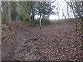
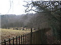
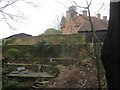
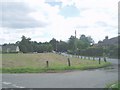
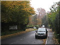
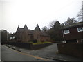
53 photos from this area
Area Information
Key information about the TN16 1TB including its size, population, and administrative classification.
- Area Type
- Postcode
- Area Size
- 21.4 hectares
- Population
- 1550
- Population Density
- 214 people/km²
House Prices in TN16 1TB
36
Properties
£583,783
Average Sold Price
£120,000
Lowest Price
£2,100,000
Highest Price
Showing 36 properties
| Address | Type | Beds | Baths | Last Sale Price | Last Sale Date | |
|---|---|---|---|---|---|---|
| Windy Ridge, Hosey Hill, Westerham, TN16 1TB | Detached | 4 | 2 | £985,000 | Aug 2023 | |
| Pass Christian, Hosey Hill, Westerham, TN16 1TB | house | - | - | £665,000 | Sep 2021 | |
| Oaklands, Hosey Hill, Westerham, TN16 1TB | Detached | 3 | 2 | £675,000 | Jun 2021 | |
| Little Amherst, Hosey Hill, Westerham, TN16 1TB | house | - | - | £367,500 | Sep 2020 | |
| Trimulgherry, Hosey Hill, Westerham, TN16 1TB | Detached | 3 | 2 | £625,000 | Jul 2020 | |
| April Cottage, Hosey Hill, Westerham, TN16 1TB | Terraced | 3 | 2 | £375,000 | May 2020 | |
| Quince Cottage, Hosey Hill, Westerham, TN16 1TB | Detached | 3 | 2 | £840,000 | Nov 2018 | |
| Longmeadow, Hosey Hill, Westerham, TN16 1TB | Detached | 6 | 6 | £2,100,000 | Dec 2017 | |
| Shawside, Hosey Hill, Westerham, TN16 1TB | Detached | 4 | - | £870,000 | Sep 2016 | |
| Little Squerryes West, Hosey Hill, Westerham, TN16 1TB | Semi-detached | 5 | 2 | £755,000 | Mar 2016 |
Page 1 of 4
Energy Efficiency in TN16 1TB
Amenities
Schools
| Rank | School | Type | Entry gender | Ages |
|---|
Explore more schools in this area
Go to Schools tabDemographics
Household Size
Two person
most common
Accommodation Type
Houses
most common
Tenure
69
majority
Ethnic Group
White
most common
Religion
N/A
most common
Household Composition
N/A
most common
Age
47
median
Adults (30-64 years)
most common
Household Deprivation
N/A
with no deprivation
NS-SEC
46
in Lower managerial occupations
Explore more demographic insights in this area
Go to Demographics tabPlanning
Planning Constraints
- Flood RiskPremium
- Ramsar Wetland SitesPremium
- Area of Outstanding Natural BeautyPremium
- Protected Nature ReservePremium
- Protected WoodlandPremium