Area Overview for TN16 1BS
Photos of TN16 1BS
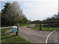
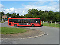
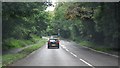
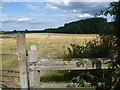
19 photos from this area
Area Information
Key information about the TN16 1BS including its size, population, and administrative classification.
- Area Type
- Postcode
- Area Size
- 4.2 hectares
- Population
- 1738
- Population Density
- 1727 people/km²
House Prices in TN16 1BS
24
Properties
£228,258
Average Sold Price
£13,500
Lowest Price
£410,000
Highest Price
Showing 24 properties
| Address | Type | Beds | Baths | Last Sale Price | Last Sale Date | |
|---|---|---|---|---|---|---|
| 4 Hollingworth Way, Westerham, TN16 1BS | Terraced | 3 | 1 | £410,000 | Jan 2025 | |
| 19 Hollingworth Way, Westerham, TN16 1BS | Retail | 3 | 1 | £395,000 | Jun 2022 | |
| 2 Hollingworth Way, Westerham, TN16 1BS | house | - | - | £390,000 | Nov 2021 | |
| 6 Hollingworth Way, Westerham, TN16 1BS | house | - | - | £389,950 | Mar 2021 | |
| 12 Hollingworth Way, Westerham, TN16 1BS | Maisonette | 2 | 1 | £250,000 | May 2020 | |
| 7 Hollingworth Way, Westerham, TN16 1BS | Terraced | 3 | 1 | £325,000 | Mar 2020 | |
| 3 Hollingworth Way, Westerham, TN16 1BS | Terraced | 3 | 1 | £328,500 | Jun 2019 | |
| 1 Hollingworth Way, Westerham, TN16 1BS | Terraced | 3 | 1 | £210,000 | Sep 2017 | |
| 21 Hollingworth Way, Westerham, TN16 1BS | Terraced | 3 | 1 | £310,000 | Mar 2017 | |
| 22 Hollingworth Way, Westerham, TN16 1BS | Terraced | 3 | 1 | £237,500 | Apr 2013 |
Page 1 of 3
Energy Efficiency in TN16 1BS
Amenities
Schools
| Rank | School | Type | Entry gender | Ages |
|---|
Explore more schools in this area
Go to Schools tabDemographics
Household Size
Family (3-5 people)
most common
Accommodation Type
Houses
most common
Tenure
60
majority
Ethnic Group
White
most common
Religion
N/A
most common
Household Composition
N/A
most common
Age
47
median
Adults (30-64 years)
most common
Household Deprivation
N/A
with no deprivation
NS-SEC
32
in Lower managerial occupations
Explore more demographic insights in this area
Go to Demographics tabPlanning
Planning Constraints
- Flood RiskPremium
- Ramsar Wetland SitesPremium
- Area of Outstanding Natural BeautyPremium
- Protected Nature ReservePremium
- Protected WoodlandPremium