Area Overview for TN15 9EA
Photos of TN15 9EA
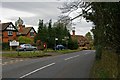
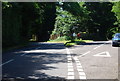
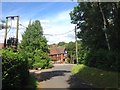
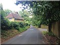
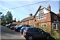
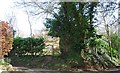
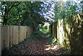
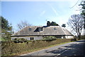
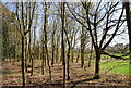
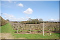
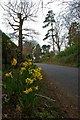
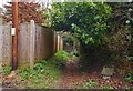
60 photos from this area
Area Information
Key information about the TN15 9EA including its size, population, and administrative classification.
- Area Type
- Postcode
- Area Size
- 9.7 hectares
- Population
- 2038
- Population Density
- 221 people/km²
House Prices in TN15 9EA
70
Properties
£630,029
Average Sold Price
£245,000
Lowest Price
£1,200,000
Highest Price
Showing 70 properties
| Address | Type | Beds | Baths | Last Sale Price | Last Sale Date | |
|---|---|---|---|---|---|---|
| 69 Nutfields, Ightham, Sevenoaks, TN15 9EA | Detached | 5 | 3 | £1,075,000 | Jan 2024 | |
| 44 Nutfields, Ightham, Sevenoaks, TN15 9EA | Detached | 4 | 3 | £1,140,000 | Oct 2023 | |
| 50 Nutfields, Ightham, Sevenoaks, TN15 9EA | house | - | - | £1,200,000 | Aug 2023 | |
| Red Robins Corner, 11 Nutfields, Ightham, Sevenoaks, TN15 9EA | house | - | - | £1,100,000 | Sep 2022 | |
| 28 Nutfields, Ightham, Sevenoaks, TN15 9EA | Detached | 4 | 3 | £1,050,000 | Aug 2022 | |
| 27 Nutfields, Ightham, Sevenoaks, TN15 9EA | Detached | 4 | 3 | £1,125,000 | Jun 2022 | |
| 58 Nutfields, Ightham, Sevenoaks, TN15 9EA | Detached | 5 | 3 | £995,000 | Nov 2021 | |
| 19 Nutfields, Ightham, Sevenoaks, TN15 9EA | house | 4 | - | £1,055,000 | Jun 2021 | |
| 62 Nutfields, Ightham, Sevenoaks, TN15 9EA | Detached | 4 | 3 | £940,000 | May 2021 | |
| 21 Nutfields, Ightham, Sevenoaks, TN15 9EA | Detached | 4 | - | £925,000 | Apr 2021 |
Page 1 of 7
Energy Efficiency in TN15 9EA
Amenities
Schools
| Rank | School | Type | Entry gender | Ages |
|---|
Explore more schools in this area
Go to Schools tabDemographics
Household Size
Family (3-5 people)
most common
Accommodation Type
Houses
most common
Tenure
89
majority
Ethnic Group
White
most common
Religion
N/A
most common
Household Composition
N/A
most common
Age
47
median
Adults (30-64 years)
most common
Household Deprivation
N/A
with no deprivation
NS-SEC
53
in Lower managerial occupations
Explore more demographic insights in this area
Go to Demographics tabPlanning
Planning Constraints
- Flood RiskPremium
- Ramsar Wetland SitesPremium
- Area of Outstanding Natural BeautyPremium
- Protected Nature ReservePremium
- Protected WoodlandPremium