Area Overview for TN15 8LU
Photos of TN15 8LU
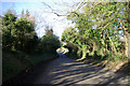
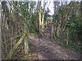
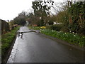
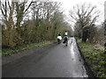
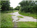
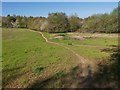
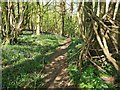
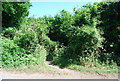
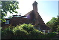
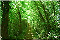
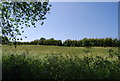
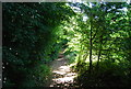
31 photos from this area
Area Information
Key information about the TN15 8LU including its size, population, and administrative classification.
- Area Type
- Postcode
- Area Size
- 19.4 hectares
- Population
- 2149
- Population Density
- 1774 people/km²
House Prices in TN15 8LU
21
Properties
£946,667
Average Sold Price
£160,000
Lowest Price
£2,800,000
Highest Price
Showing 21 properties
| Address | Type | Beds | Baths | Last Sale Price | Last Sale Date | |
|---|---|---|---|---|---|---|
| Redstone House, 97 Crouch Lane, Borough Green, Sevenoaks, TN15 8LU | Detached | 4 | 2 | £2,375,000 | Jan 2022 | |
| 2 Crouch Lane, Borough Green, Sevenoaks, TN15 8LU | Detached | 3 | 1 | £386,000 | Jan 2020 | |
| 3 Crouch Lane, Borough Green, Sevenoaks, TN15 8LU | Bungalow | 3 | 1 | £350,000 | Aug 2018 | |
| Pine Hall, 82 Crouch Lane, Borough Green, Sevenoaks, TN15 8LU | house | - | - | £2,800,000 | Oct 2015 | |
| Birchtrees, 45 Crouch Lane, Borough Green, Sevenoaks, TN15 8LU | Detached | 4 | 2 | £382,500 | Aug 2012 | |
| Platt Edge, 49 Crouch Lane, Borough Green, Sevenoaks, TN15 8LU | house | - | - | £805,000 | Dec 2007 | |
| The Paddock House, 78 Crouch Lane, Borough Green, Sevenoaks, TN15 8LU | Detached | - | - | £1,500,000 | Jul 2006 | |
| Longwood House, 80 Crouch Lane, Borough Green, Sevenoaks, TN15 8LU | Detached | - | - | £1,500,000 | Apr 2003 | |
| Southover, 99 Crouch Lane, Borough Green, Sevenoaks, TN15 8LU | Detached | - | - | £545,000 | Jul 2000 | |
| Oak View, 70 Crouch Lane, Borough Green, Sevenoaks, TN15 8LU | Detached | - | - | £160,000 | Jun 1998 |
Page 1 of 3
Energy Efficiency in TN15 8LU
Amenities
Schools
| Rank | School | Type | Entry gender | Ages |
|---|
Explore more schools in this area
Go to Schools tabDemographics
Household Size
Family (3-5 people)
most common
Accommodation Type
Houses
most common
Tenure
78
majority
Ethnic Group
White
most common
Religion
N/A
most common
Household Composition
N/A
most common
Age
47
median
Adults (30-64 years)
most common
Household Deprivation
N/A
with no deprivation
NS-SEC
41
in Lower managerial occupations
Explore more demographic insights in this area
Go to Demographics tabPlanning
Planning Constraints
- Flood RiskPremium
- Ramsar Wetland SitesPremium
- Area of Outstanding Natural BeautyPremium
- Protected Nature ReservePremium
- Protected WoodlandPremium