Area Overview for TN15 7BT
Photos of TN15 7BT
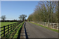
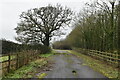
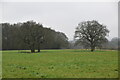
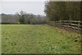
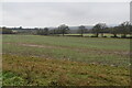
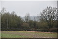
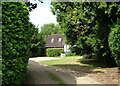


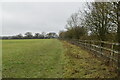
15 photos from this area
Area Information
Key information about the TN15 7BT including its size, population, and administrative classification.
- Area Type
- Postcode
- Area Size
- 30.7 hectares
- Population
- 1961
- Population Density
- 142 people/km²
House Prices in TN15 7BT
7
Properties
£467,900
Average Sold Price
£225,000
Lowest Price
£847,000
Highest Price
Showing 7 properties
| Address | Type | Beds | Baths | Last Sale Price | Last Sale Date | |
|---|---|---|---|---|---|---|
| The Cottage, Kemsing Road, Wrotham, Sevenoaks, TN15 7BT | Detached | 4 | 2 | £847,000 | Oct 2024 | |
| The Ark, Kemsing Road, Wrotham, Sevenoaks, TN15 7BT | Detached | 5 | 3 | £575,000 | Jun 2015 | |
| 2, Horseshoe Cottage, Meadowview, Kemsing Road, Wrotham, Sevenoaks, TN15 7BT | house | - | - | £235,000 | Dec 2008 | |
| West Bank, Kemsing Road, Wrotham, Sevenoaks, TN15 7BT | house | - | - | £457,500 | Nov 2003 | |
| Melrose, Kemsing Road, Wrotham, Sevenoaks, TN15 7BT | Detached | 6 | 3 | £225,000 | Jul 1997 | |
| 1, Meadow View, Kemsing Road, Wrotham, Sevenoaks, TN15 7BT | Semi-detached | 3 | 2 | - | - | |
| Cedarwood, Kemsing Road, Wrotham, Sevenoaks, TN15 7BT | Detached | - | - | - | - |
Energy Efficiency in TN15 7BT
Amenities
Schools
| Rank | School | Type | Entry gender | Ages |
|---|
Explore more schools in this area
Go to Schools tabDemographics
Household Size
Family (3-5 people)
most common
Accommodation Type
Houses
most common
Tenure
70
majority
Ethnic Group
White
most common
Religion
N/A
most common
Household Composition
N/A
most common
Age
47
median
Adults (30-64 years)
most common
Household Deprivation
N/A
with no deprivation
NS-SEC
38
in Lower managerial occupations
Explore more demographic insights in this area
Go to Demographics tabPlanning
Planning Constraints
- Flood RiskPremium
- Ramsar Wetland SitesPremium
- Area of Outstanding Natural BeautyPremium
- Protected Nature ReservePremium
- Protected WoodlandPremium