Area Overview for TN15 6XR
Photos of TN15 6XR
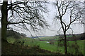
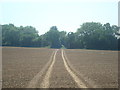
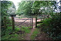
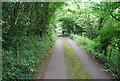
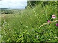
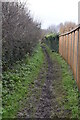
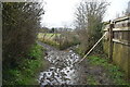
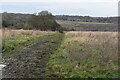
52 photos from this area
Area Information
Key information about the TN15 6XR including its size, population, and administrative classification.
- Area Type
- Postcode
- Area Size
- 1.0 km²
- Population
- 1483
- Population Density
- 92 people/km²
House Prices in TN15 6XR
9
Properties
£564,688
Average Sold Price
£180,000
Lowest Price
£1,140,000
Highest Price
Showing 9 properties
| Address | Type | Beds | Baths | Last Sale Price | Last Sale Date | |
|---|---|---|---|---|---|---|
| Oakdene, Romney Street, Knatts Valley, TN15 6XR | Detached | 5 | 2 | £1,115,000 | Aug 2025 | |
| 1, Courtfield Cottage, Romney Street, Knatts Valley, TN15 6XR | house | 4 | 1 | £615,000 | Oct 2021 | |
| Barnfield House, Romney Street, Knatts Valley, TN15 6XR | house | - | - | £1,140,000 | Jun 2021 | |
| Poldhu, Romney Street, Knatts Valley, TN15 6XR | Bungalow | 3 | 1 | £430,000 | Jan 2021 | |
| Macandy, Romney Street, Knatts Valley, TN15 6XR | Mobile Home | - | - | £180,000 | Aug 2019 | |
| Corner House, Romney Street, Knatts Valley, TN15 6XR | Detached | 3 | 1 | £350,000 | Jan 2015 | |
| Mandalay, Romney Street, Knatts Valley, TN15 6XR | Detached | 3 | 2 | £447,500 | Oct 2012 | |
| 2, Courtfield Cottage, Romney Street, Knatts Valley, TN15 6XR | house | - | - | £240,000 | May 2010 | |
| Romney Street Farm, Romney Street, Knatts Valley, TN15 6XR | house | 2 | - | - | - |
Energy Efficiency in TN15 6XR
Amenities
Schools
| Rank | School | Type | Entry gender | Ages |
|---|
Explore more schools in this area
Go to Schools tabDemographics
Household Size
Family (3-5 people)
most common
Accommodation Type
Houses
most common
Tenure
71
majority
Ethnic Group
White
most common
Religion
N/A
most common
Household Composition
N/A
most common
Age
47
median
Adults (30-64 years)
most common
Household Deprivation
N/A
with no deprivation
NS-SEC
44
in Lower managerial occupations
Explore more demographic insights in this area
Go to Demographics tabPlanning
Planning Constraints
- Flood RiskPremium
- Ramsar Wetland SitesPremium
- Area of Outstanding Natural BeautyPremium
- Protected Nature ReservePremium
- Protected WoodlandPremium