Area Overview for TN15 0HX
Photos of TN15 0HX

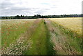
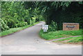
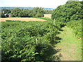
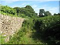


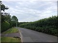
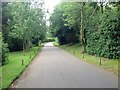

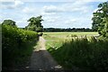
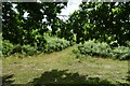
56 photos from this area
Area Information
Key information about the TN15 0HX including its size, population, and administrative classification.
- Area Type
- Postcode
- Area Size
- 20.0 hectares
- Population
- 1415
- Population Density
- 113 people/km²
House Prices in TN15 0HX
27
Properties
£2,847,131
Average Sold Price
£1,100,000
Lowest Price
£5,195,000
Highest Price
Showing 27 properties
| Address | Type | Beds | Baths | Last Sale Price | Last Sale Date | |
|---|---|---|---|---|---|---|
| Quarries, Parkfield, Sevenoaks, TN15 0HX | house | - | - | £3,720,000 | Jan 2025 | |
| Site Of Tanglewood, Parkfield, Sevenoaks, TN15 0HX | Detached | 5 | 2 | £2,450,000 | Mar 2022 | |
| Fairlawn, Parkfield, Sevenoaks, TN15 0HX | house | - | - | £2,499,950 | Sep 2020 | |
| Roseneath, Parkfield, Sevenoaks, TN15 0HX | Detached | 5 | 3 | £3,000,000 | May 2020 | |
| Rivendell, Parkfield, Sevenoaks, TN15 0HX | Detached | 7 | 5 | £5,195,000 | Jun 2019 | |
| Springmead, Parkfield, Sevenoaks, TN15 0HX | Detached | 5 | - | £4,250,000 | Dec 2017 | |
| The Summer House, Parkfield, Sevenoaks, TN15 0HX | house | - | - | £4,500,000 | Aug 2017 | |
| Oak Lodge, Parkfield, Sevenoaks, TN15 0HX | house | - | - | £4,000,000 | Jun 2017 | |
| Raggleswood, Parkfield, Sevenoaks, TN15 0HX | house | - | - | £1,900,000 | Aug 2015 | |
| Farthings, Parkfield, Sevenoaks, TN15 0HX | house | 5 | - | £2,496,000 | Aug 2014 |
Page 1 of 3
Energy Efficiency in TN15 0HX
Amenities
Schools
| Rank | School | Type | Entry gender | Ages |
|---|
Explore more schools in this area
Go to Schools tabDemographics
Household Size
Family (3-5 people)
most common
Accommodation Type
Houses
most common
Tenure
83
majority
Ethnic Group
White
most common
Religion
N/A
most common
Household Composition
N/A
most common
Age
47
median
Adults (30-64 years)
most common
Household Deprivation
N/A
with no deprivation
NS-SEC
58
in Lower managerial occupations
Explore more demographic insights in this area
Go to Demographics tabPlanning
Planning Constraints
- Flood RiskPremium
- Ramsar Wetland SitesPremium
- Area of Outstanding Natural BeautyPremium
- Protected Nature ReservePremium
- Protected WoodlandPremium