Area Overview for TN15 0BS
Photos of TN15 0BS
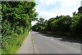
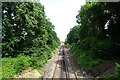
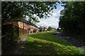
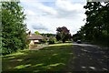
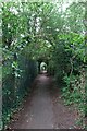
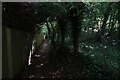
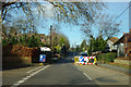
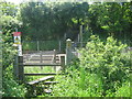
27 photos from this area
Area Information
Key information about the TN15 0BS including its size, population, and administrative classification.
- Area Type
- Postcode
- Area Size
- 7377 m²
- Population
- 1299
- Population Density
- 1268 people/km²
House Prices in TN15 0BS
6
Properties
£637,500
Average Sold Price
£240,000
Lowest Price
£885,000
Highest Price
Showing 6 properties
| Address | Type | Beds | Baths | Last Sale Price | Last Sale Date | |
|---|---|---|---|---|---|---|
| Vista, Childsbridge Lane, Seal, TN15 0BS | Detached | 4 | 2 | £885,000 | Nov 2024 | |
| Rostrevor, Childsbridge Lane, Seal, TN15 0BS | house | - | - | £650,000 | Mar 2021 | |
| Claremont, Childsbridge Lane, Seal, TN15 0BS | Detached | 5 | - | £775,000 | Jul 2014 | |
| Landswood, Childsbridge Lane, Seal, TN15 0BS | Detached | 5 | 3 | £240,000 | Jul 1997 | |
| Half Orchard, Childsbridge Lane, Seal, TN15 0BS | Detached | - | - | - | - | |
| The Chase, Childsbridge Lane, Seal, TN15 0BS | Semi-detached | - | - | - | - |
Energy Efficiency in TN15 0BS
Amenities
Schools
| Rank | School | Type | Entry gender | Ages |
|---|
Explore more schools in this area
Go to Schools tabDemographics
Household Size
Family (3-5 people)
most common
Accommodation Type
Houses
most common
Tenure
63
majority
Ethnic Group
White
most common
Religion
N/A
most common
Household Composition
N/A
most common
Age
47
median
Adults (30-64 years)
most common
Household Deprivation
N/A
with no deprivation
NS-SEC
39
in Lower managerial occupations
Explore more demographic insights in this area
Go to Demographics tabPlanning
Planning Constraints
- Flood RiskPremium
- Ramsar Wetland SitesPremium
- Area of Outstanding Natural BeautyPremium
- Protected Nature ReservePremium
- Protected WoodlandPremium