Area Overview for TN14 5RL
Photos of TN14 5RL
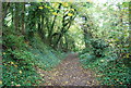
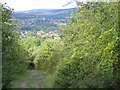
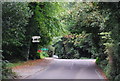
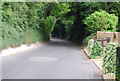
77 photos from this area
Area Information
Key information about the TN14 5RL including its size, population, and administrative classification.
- Area Type
- Postcode
- Area Size
- 4.4 hectares
- Population
- 1675
- Population Density
- 631 people/km²
House Prices in TN14 5RL
31
Properties
£1,019,441
Average Sold Price
£225,000
Lowest Price
£1,705,500
Highest Price
Showing 31 properties
| Address | Type | Beds | Baths | Last Sale Price | Last Sale Date | |
|---|---|---|---|---|---|---|
| Downsview, Shoreham Road, Otford, TN14 5RL | Detached | 6 | 3 | £1,615,000 | Apr 2024 | |
| Brambles, Shoreham Road, Otford, TN14 5RL | house | - | - | £1,705,500 | Sep 2021 | |
| Wildwood, Shoreham Road, Otford, TN14 5RL | house | - | - | £1,630,000 | Jul 2019 | |
| Albany, Shoreham Road, Otford, TN14 5RL | Detached | 4 | 2 | £835,000 | Nov 2017 | |
| The Laurels, Shoreham Road, Otford, TN14 5RL | house | - | - | £1,365,000 | Aug 2017 | |
| Orchard House, Shoreham Road, Otford, TN14 5RL | Detached | 5 | 4 | £1,525,000 | Dec 2016 | |
| The Oast House, Shoreham Road, Otford, TN14 5RL | house | 5 | 3 | £1,150,000 | Nov 2013 | |
| Bramber House, Shoreham Road, Otford, TN14 5RL | house | - | - | £1,200,000 | Nov 2009 | |
| Sarnia House, Shoreham Road, Otford, TN14 5RL | Detached | 4 | 4 | £1,125,000 | Oct 2009 | |
| Crammond, Shoreham Road, Otford, TN14 5RL | Detached | 6 | 3 | £725,000 | Feb 2007 |
Page 1 of 4
Energy Efficiency in TN14 5RL
Amenities
Schools
| Rank | School | Type | Entry gender | Ages |
|---|
Explore more schools in this area
Go to Schools tabDemographics
Household Size
Family (3-5 people)
most common
Accommodation Type
Houses
most common
Tenure
91
majority
Ethnic Group
White
most common
Religion
N/A
most common
Household Composition
N/A
most common
Age
47
median
Adults (30-64 years)
most common
Household Deprivation
N/A
with no deprivation
NS-SEC
57
in Lower managerial occupations
Explore more demographic insights in this area
Go to Demographics tabPlanning
Planning Constraints
- Flood RiskPremium
- Ramsar Wetland SitesPremium
- Area of Outstanding Natural BeautyPremium
- Protected Nature ReservePremium
- Protected WoodlandPremium