Area Overview for TN14 5PH
Photos of TN14 5PH
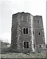
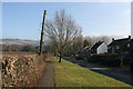
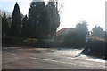
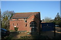
100 photos from this area
Area Information
Key information about the TN14 5PH including its size, population, and administrative classification.
- Area Type
- Postcode
- Area Size
- 13.1 hectares
- Population
- 1483
- Population Density
- 92 people/km²
House Prices in TN14 5PH
29
Properties
£443,560
Average Sold Price
£103,500
Lowest Price
£770,000
Highest Price
Showing 29 properties
| Address | Type | Beds | Baths | Last Sale Price | Last Sale Date | |
|---|---|---|---|---|---|---|
| 92 High Street, Otford, TN14 5PH | Semi-detached | 3 | 1 | £570,000 | Dec 2019 | |
| 78 High Street, Otford, TN14 5PH | Semi-detached | 3 | 1 | £597,980 | Oct 2019 | |
| The Chalet, High Street, Otford, TN14 5PH | Bungalow | - | - | £337,000 | Mar 2017 | |
| 72 High Street, Otford, TN14 5PH | Semi-detached | 1 | 1 | £295,000 | Dec 2014 | |
| 76 High Street, Otford, TN14 5PH | Semi-detached | 4 | 2 | £770,000 | Dec 2014 | |
| The Mill House, High Street, Otford, TN14 5PH | Detached | - | - | £425,000 | Sep 2013 | |
| Waterside Cottage, High Street, Otford, TN14 5PH | Semi-detached | 4 | 1 | £450,000 | May 2007 | |
| Patchers Cottage, 70 High Street, Otford, TN14 5PH | Semi-detached | - | - | £103,500 | Apr 1995 | |
| Bridge Cottage West, High Street, Otford, TN14 5PH | Semi-detached | 2 | 1 | - | - | |
| 66A High Street, Otford, TN14 5PH | Semi-detached | 3 | 2 | - | - |
Page 1 of 3
Energy Efficiency in TN14 5PH
Amenities
Schools
| Rank | School | Type | Entry gender | Ages |
|---|
Explore more schools in this area
Go to Schools tabDemographics
Household Size
Family (3-5 people)
most common
Accommodation Type
Houses
most common
Tenure
71
majority
Ethnic Group
White
most common
Religion
N/A
most common
Household Composition
N/A
most common
Age
47
median
Adults (30-64 years)
most common
Household Deprivation
N/A
with no deprivation
NS-SEC
44
in Lower managerial occupations
Explore more demographic insights in this area
Go to Demographics tabPlanning
Planning Constraints
- Flood RiskPremium
- Ramsar Wetland SitesPremium
- Area of Outstanding Natural BeautyPremium
- Protected Nature ReservePremium
- Protected WoodlandPremium