Area Overview for TN13 3XB
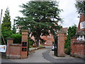
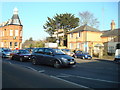
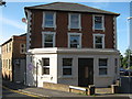
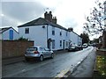
Photos of TN13 3XB


Area Information
TN13 3XB is a small residential cluster covering an area of 2422 m². This postcode serves a population of 2440 people, creating a tight-knit neighbourhood where residents share close proximity. As a specific postcode area in England, it functions as a distinct pocket within the broader local landscape. Life here is defined by this concentration of homes, which fosters a sense of stability and community among those choosing to live in TN13 3XB. The area is characterised by its residential focus, offering a quiet environment away from the busiest parts of the town. You will find that daily life revolves around established routines, supported by the reliable amenities found nearby. The small size of the territory means that residents often know their neighbours, contributing to a secure and predictable living environment. For anyone looking for homes in TN13 3XB, the setting provides a clear sense of place without the chaos of larger urban developments.
- Area Type
- Postcode
- Area Size
- 2422 m²
- Population
- 2440
- Population Density
- 2709 people/km²
Living in TN13 3XB means engaging with a property market defined by stability and ownership rather than speculation. The data indicates that houses are the standard accommodation type, which aligns perfectly with the 66% home ownership rate found here. This high percentage of owner-occupied dwellings suggests that the area attracts buyers who intend to stay for the long term. You are unlikely to find a volatile rental market, as the majority of the housing stock changes hands through traditional sale processes. The nature of the homes in TN13 3XB points towards a preference for traditional family living spaces rather than city-centre flats. This market environment offers security for both sellers and buyers, as the demand is driven by families seeking established neighbourhoods. The specific postcode designation helps refine property searches, allowing you to target homes in TN13 3XB with precision. When looking at the housing stock, you will find that the physical layout supports the high rate of ownership seen in the demographic data.
House Prices in TN13 3XB
Showing 10 properties
Energy Efficiency in TN13 3XB
Residents of TN13 3XB enjoy convenient access to a variety of amenities within practical reach. Your daily shopping needs can be met at Morrisons Daily Sevenoaks, Sainsburys Sevenoaks St, or M&S Sevenoaks. These major retailers are located nearby, ensuring that groceries and household items are always accessible. If you prefer to travel by train, you have several railway stations close by, including Bat & Ball Railway Station, Sevenoaks Railway Station, and Dunton Green Railway Station. These transport hubs offer straightforward rail connections for commuters and travellers alike. The presence of both comprehensive retail outlets and multiple rail options defines the lifestyle convenience of this area. You do not need to venture far to complete essential errands or catch your morning train. This blend of local shops and transport links makes living in TN13 3XB practical and manageable. Every resident benefits from this immediate access to services and connectivity.
Amenities
Schools
Families considering homes in TN13 3XB have access to a mix of education options within a short distance. St John's Church of England Primary School, Sevenoaks stands out as the nearest primary option, holding a Good rating from Ofsted. This state school provides a solid foundation for younger children living in the area. For those seeking independent education, Walthamstow Hall is available nearby as an independent school option. The presence of both state and independent institutions gives residents significant flexibility when choosing schooling for their children. Having a primary school with a Good rating nearby ensures that the needs of children in TN13 3XB are met with a standard of quality. The distance to these schools keeps families close to their children's educational environments while maintaining their privacy. This selection of schools means you do not need to travel far to support your child's academic development.
| Rank | School | Type | Entry gender | Ages |
|---|
Explore more schools in this area
Go to Schools tabDemographics
The community living in TN13 3XB has a median age of 47 years, indicating that the local population is older than the national average. Adults aged between 30 and 64 years represent the most common age range within this postcode. Home ownership is a defining feature of the area, with 66% of residents owning their properties outright or with a mortgage. This high ownership rate suggests a settled community where families have put down long-term roots. The predominant ethnic group in TN13 3XB is White, reflecting the demographic makeup typical of many established English suburbs. Houses form the primary accommodation type, meaning the streetscape is dominated by detached or semi-detached dwellings rather than apartment blocks. This housing stock caters to families and individuals seeking space and privacy. With 66% of residents owning their homes, the area feels less transient than many rental-heavy pockets. You are less likely to encounter short-term letting issues, which contributes to the quiet, residential nature of this cluster.
Household Size
Accommodation Type
Tenure
Ethnic Group
Religion
Household Composition
Age
Household Deprivation
NS-SEC
Explore more demographic insights in this area
Go to Demographics tabPlanning
Planning Constraints
- Flood RiskPremium
- Ramsar Wetland SitesPremium
- Area of Outstanding Natural BeautyPremium
- Protected Nature ReservePremium
- Protected WoodlandPremium