Area Overview for TN13 3UQ
Photos of TN13 3UQ
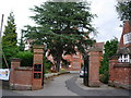
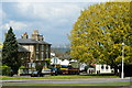
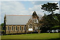
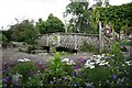
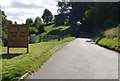
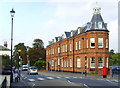
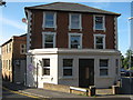
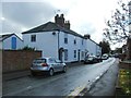
100 photos from this area
Area Information
Key information about the TN13 3UQ including its size, population, and administrative classification.
- Area Type
- Postcode
- Area Size
- 1.0 hectares
- Population
- 1668
- Population Density
- 3061 people/km²
House Prices in TN13 3UQ
13
Properties
£605,250
Average Sold Price
£240,000
Lowest Price
£1,085,000
Highest Price
Showing 13 properties
| Address | Type | Beds | Baths | Last Sale Price | Last Sale Date | |
|---|---|---|---|---|---|---|
| 3 Egdean Walk, Sevenoaks, TN13 3UQ | Detached | 4 | 2 | £1,085,000 | May 2023 | |
| 5 Egdean Walk, Sevenoaks, TN13 3UQ | Detached | 4 | 2 | £792,500 | Feb 2014 | |
| 2 Egdean Walk, Sevenoaks, TN13 3UQ | Detached | 4 | - | £675,000 | Jul 2013 | |
| 14 Egdean Walk, Sevenoaks, TN13 3UQ | Bungalow | - | - | £510,000 | Dec 2012 | |
| 12 Egdean Walk, Sevenoaks, TN13 3UQ | Detached | 4 | 2 | £580,000 | Oct 2006 | |
| 1 Egdean Walk, Sevenoaks, TN13 3UQ | Detached | - | - | £460,000 | Oct 2006 | |
| 6 Egdean Walk, Sevenoaks, TN13 3UQ | Detached | 4 | 3 | £499,500 | May 2003 | |
| 4 Egdean Walk, Sevenoaks, TN13 3UQ | Detached | - | - | £240,000 | Aug 1998 | |
| The Belvoir, 7 Egdean Walk, Sevenoaks, TN13 3UQ | Detached | 4 | 2 | - | - | |
| 8 Egdean Walk, Sevenoaks, TN13 3UQ | Detached | - | - | - | - |
Page 1 of 2
Energy Efficiency in TN13 3UQ
Amenities
Schools
| Rank | School | Type | Entry gender | Ages |
|---|
Explore more schools in this area
Go to Schools tabDemographics
Household Size
Family (3-5 people)
most common
Accommodation Type
Houses
most common
Tenure
71
majority
Ethnic Group
White
most common
Religion
N/A
most common
Household Composition
N/A
most common
Age
47
median
Adults (30-64 years)
most common
Household Deprivation
N/A
with no deprivation
NS-SEC
62
in Lower managerial occupations
Explore more demographic insights in this area
Go to Demographics tabPlanning
Planning Constraints
- Flood RiskPremium
- Ramsar Wetland SitesPremium
- Area of Outstanding Natural BeautyPremium
- Protected Nature ReservePremium
- Protected WoodlandPremium