Area Overview for TN13 3UP
Photos of TN13 3UP
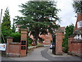
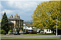
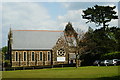
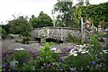

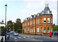
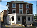
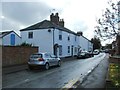
100 photos from this area
Area Information
Key information about the TN13 3UP including its size, population, and administrative classification.
- Area Type
- Postcode
- Area Size
- 2.5 hectares
- Population
- 2440
- Population Density
- 2709 people/km²
House Prices in TN13 3UP
15
Properties
£1,036,875
Average Sold Price
£295,000
Lowest Price
£1,755,000
Highest Price
Showing 15 properties
| Address | Type | Beds | Baths | Last Sale Price | Last Sale Date | |
|---|---|---|---|---|---|---|
| 7 Park Lane, Sevenoaks, TN13 3UP | Maisonette | 3 | 1 | £1,100,000 | Feb 2024 | |
| 3 Park Lane, Sevenoaks, TN13 3UP | Detached | 4 | 2 | £1,100,000 | May 2023 | |
| 10 Park Lane, Sevenoaks, TN13 3UP | house | - | - | £1,485,000 | Jan 2018 | |
| 14 Park Lane, Sevenoaks, TN13 3UP | Detached | 4 | 2 | £870,000 | Aug 2017 | |
| 11 Park Lane, Sevenoaks, TN13 3UP | Flat | - | - | £340,000 | Apr 2017 | |
| 8 Park Lane, Sevenoaks, TN13 3UP | house | - | - | £1,755,000 | Jul 2016 | |
| 5 Park Lane, Sevenoaks, TN13 3UP | house | 5 | - | £1,350,000 | Mar 2011 | |
| 2 Park Lane, Sevenoaks, TN13 3UP | Terraced | - | - | £295,000 | Mar 1996 | |
| Upper Flat, 12 Park Lane, Sevenoaks, TN13 3UP | Semi-detached | 6 | 3 | - | - | |
| 1 Park Lane, Sevenoaks, TN13 3UP | Detached | 7 | 4 | - | - |
Page 1 of 2
Energy Efficiency in TN13 3UP
Amenities
Schools
| Rank | School | Type | Entry gender | Ages |
|---|
Explore more schools in this area
Go to Schools tabDemographics
Household Size
Family (3-5 people)
most common
Accommodation Type
Houses
most common
Tenure
66
majority
Ethnic Group
White
most common
Religion
N/A
most common
Household Composition
N/A
most common
Age
47
median
Adults (30-64 years)
most common
Household Deprivation
N/A
with no deprivation
NS-SEC
55
in Lower managerial occupations
Explore more demographic insights in this area
Go to Demographics tabPlanning
Planning Constraints
- Flood RiskPremium
- Ramsar Wetland SitesPremium
- Area of Outstanding Natural BeautyPremium
- Protected Nature ReservePremium
- Protected WoodlandPremium