Area Overview for TN13 2SA
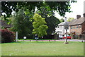
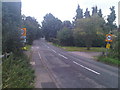
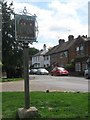
Photos of TN13 2SA


Area Information
Living in TN13 2SA means settling into a specific residential cluster covering 65.2 hectares. This postcode in Kent accommodates 1,714 residents, resulting in a population density of 113 people per square kilometre. You will find that this area is defined by its scale as a small, focused community rather than a sprawling suburb. The layout supports a quiet lifestyle where neighbours are regular sights yet individual privacy remains intact. This demographic concentration creates a residential environment where daily life moves at a steady pace, away from the denser pressures of larger urban centres. The area functions as a distinct pocket within the broader Sevenoaks and Dunton Green corridor. Most of the 1,714 residents call a house their home, reflecting a established pattern of settled living. The moderate density of 113 people per square kilometre ensures that green spaces and local streets retain their character without feeling commercial or congested. When you visit TN13 2SA, you experience a neighbourhood designed for residence rather than transit. It offers a compact footprint where local infrastructure serves a clear, defined population. The character of TN13 2SA is rooted in stability and long-term habitation. The small total area of 65.2 hectares means that walking distances to local hubs are generally short and predictable. This spatial constraint fosters a sense of place where the community boundaries are well understood by those living here. You are looking at a location that has maintained its residential identity, avoiding the commercial sprawl often found in larger postcode zones. The environment is suited for those who value a contained neighbourhood over a vast, anonymous landscape.
- Area Type
- Postcode
- Area Size
- 65.2 hectares
- Population
- 1714
- Population Density
- 113 people/km²
The property market in TN13 2SA is characterised as an overwhelmingly owner-occupied zone. With 79% of the 1,714 households owning their accommodation, the area functions as a primary residence destination rather than a commuter rental hub. The accommodation type is exclusively houses, meaning you will find a wide range of detached, semi-detached, or terraced properties depending on the specific street within the 65.2-hectare cluster. There are no flats or purpose-build rental conversions in this specific postcode. This market structure indicates that properties in TN13 2SA are often held for long periods before sale. Buyers looking at homes in this area should expect to engage with owners who have likely lived there for many years. The 79% ownership statistic suggests a stable market where property values may be driven by local improvements and aesthetic preservation rather than speculative investment flows. You are purchasing a home in a community defined by tenure security rather than short-term leasing cultures. Homes in TN13 2SA cater to families and individuals seeking permanent residence. The fact that the area is 100% house-based ensures compatibility for those seeking gardens, driveways, and traditional living arrangements. The lack of rental stock means that the local housing stock is fixed and finite. This reality applies to anyone considering moving their home to this specific postcode.
House Prices in TN13 2SA
Showing 39 properties
| Address | Type | Beds | Baths | Last Sale Price | Last Sale Date | |
|---|---|---|---|---|---|---|
| 103 Chevening Road, Chipstead, TN13 2SA | house | 4 | 2 | £925,000 | Mar 2025 | |
| 56 Chevening Road, Chipstead, TN13 2SA | Bungalow | 4 | 2 | £823,000 | Mar 2025 | |
| 93 Chevening Road, Chipstead, TN13 2SA | Terraced | 3 | 1 | £500,000 | Jun 2024 | |
| Beaufort House, Chevening Road, Chipstead, TN13 2SA | Detached | 5 | 5 | £1,150,000 | Sep 2023 | |
| 109 Chevening Road, Chipstead, TN13 2SA | Detached | 4 | 1 | £795,000 | Sep 2023 | |
| 60 Chevening Road, Chipstead, TN13 2SA | Bungalow | 4 | 1 | £795,000 | Sep 2022 | |
| Sleepers, Chevening Road, Chipstead, TN13 2SA | Detached | 4 | 1 | £775,000 | Sep 2020 | |
| 46 Chevening Road, Chipstead, TN13 2SA | Detached | 4 | 2 | £540,000 | Apr 2019 | |
| Boot Lodge, Chevening Road, Chipstead, TN13 2SA | Detached | 4 | 2 | £805,000 | Apr 2019 | |
| 95 Chevening Road, Chipstead, TN13 2SA | Terraced | 2 | - | £415,000 | Mar 2019 |
Energy Efficiency in TN13 2SA
Residents of TN13 2SA benefit from a practical network of amenities within practical reach, avoiding the need for long commutes to town centres. The area is flanked by five retail outlets, specifically including Tesco Sevenoaks, Lidl Sevenoaks, and Waitrose Little Waitrose Shell. These three major brands offer a convenient selection of groceries and daily goods close enough for residents to shop regularly. You can restock your household in TN13 2SA without travelling far. Transport connections are also well positioned, with five railway stations nearby. Dunton Green Railway Station, Sevenoaks Railway Station, and Bat & Ball Railway Station provide rail links for commuters. These stations facilitate easy travel to London and other parts of Kent. Additionally, two airports, London Biggin Hill Airport and Biggin Hill Airport, are accessible to residents who need air travel. This transport mix ensures that TN13 2SA is not isolated despite its residential clustering. The combination of major supermarkets and rail hubs creates a lifestyle that balances convenience with access. You can enjoy a countryside feel in TN13 2SA while knowing that shops and trains are within driving or cycling distance. The presence of Waitrose and Lidl adds variety to local shopping options. The rail network supports the 1,714 people living in this area who may need to travel outside the local cluster.
Amenities
Schools
Families living in TN13 2SA have access to a single named primary school in the immediate vicinity. St Botolph's Church of England Voluntary Aided Primary School, also known as Chevening Primary School, operates within reach of the local residents. This institution holds a 'good' Ofsted rating, providing a standard of education that meets national expectations for primary learning. The school is situated near the area, offering convenience for the 1,714 residents who may have children requiring primary education. The educational landscape in TN13 2SA is currently limited to this one option within the specified data. While secondary schools are not listed for this specific postcode, the presence of a 'good' rated primary school suggests a supportive local education environment. The Church of England Voluntary Aided status indicates that the school follows both religious and state curriculum guidelines. Parents considering schools near TN13 2SA must navigate to find secondary education, as the primary option is singular for this cluster. The proximity of St Botolph's Primary School is a practical asset for households within the 1,714-population limit. The 'good' rating provides assurance that children will receive a standard education while attending a local institution. You can rely on this school as the main educational resource identified for families in TN13 2SA. The data confirms that the area supports primary education requirements with a validated institution nearby.
| Rank | School | Type | Entry gender | Ages |
|---|
Explore more schools in this area
Go to Schools tabDemographics
The community in TN13 2SA reflects a settled population with a median age of 47 years. Most residents fall into the 30 to 64 years age range, indicating a workforce and family demographic that has put down roots. You will find that few families are transient; instead, the area supports a generation seeking stability. The home ownership rate stands at 79%, meaning that the vast majority of the 1,714 households live in properties they own outright or have a significant mortgage. Accommodation in TN13 2SA consists almost entirely of houses, aligning with the ownership preferences of the local population. This type of housing stock suggests a preference for larger living spaces compared to flats or terraced homes found in city centres. The predominant ethnic group is White, which mirrors the broader Kent and Southeast England demographic profile. There is little evidence of significant recent migration altering the social fabric of this postcode. The high rate of home ownership in TN13 2SA creates a neighbourhood with a vested interest in long-term property values and local improvement. With 79% of residents owning their homes, the atmosphere tends to be one of permanence. The age profile of 47 years median suggests that many children have already left home, potentially creating a quieter environment compared to younger suburbs. The demographic data confirms a stable community where the majority of residents are established homeowners living in houses.
Household Size
Accommodation Type
Tenure
Ethnic Group
Religion
Household Composition
Age
Household Deprivation
NS-SEC
Explore more demographic insights in this area
Go to Demographics tabPlanning
Planning Constraints
- Flood RiskPremium
- Ramsar Wetland SitesPremium
- Area of Outstanding Natural BeautyPremium
- Protected Nature ReservePremium
- Protected WoodlandPremium