Area Overview for TN13 2RB
Photos of TN13 2RB

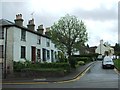
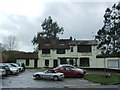
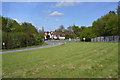
50 photos from this area
Area Information
Key information about the TN13 2RB including its size, population, and administrative classification.
- Area Type
- Postcode
- Area Size
- 3.0 hectares
- Population
- 1445
- Population Density
- 3109 people/km²
House Prices in TN13 2RB
32
Properties
£652,819
Average Sold Price
£182,500
Lowest Price
£980,000
Highest Price
Showing 32 properties
| Address | Type | Beds | Baths | Last Sale Price | Last Sale Date | |
|---|---|---|---|---|---|---|
| Pendower, 56 Woodfields, Chipstead, TN13 2RB | Detached | 4 | 1 | £980,000 | Feb 2024 | |
| 62 Woodfields, Chipstead, TN13 2RB | Bungalow | 3 | 2 | £812,000 | Nov 2022 | |
| 55 Woodfields, Chipstead, TN13 2RB | Detached | 4 | 2 | £950,000 | Aug 2022 | |
| 34 Woodfields, Chipstead, TN13 2RB | Detached | 4 | - | £775,000 | Nov 2020 | |
| 61 Woodfields, Chipstead, TN13 2RB | Bungalow | 4 | - | £855,000 | Oct 2019 | |
| 43 Woodfields, Chipstead, TN13 2RB | house | - | - | £850,000 | Jun 2017 | |
| 38 Woodfields, Chipstead, TN13 2RB | Detached | 4 | 2 | £775,000 | Mar 2016 | |
| 48 Woodfields, Chipstead, TN13 2RB | house | - | - | £715,000 | Sep 2013 | |
| 36 Woodfields, Chipstead, TN13 2RB | Detached | 4 | - | £685,000 | Aug 2013 | |
| The Gate House, 32 Woodfields, Chipstead, TN13 2RB | house | - | - | £881,515 | Jul 2013 |
Page 1 of 4
Energy Efficiency in TN13 2RB
Amenities
Schools
| Rank | School | Type | Entry gender | Ages |
|---|
Explore more schools in this area
Go to Schools tabDemographics
Household Size
Family (3-5 people)
most common
Accommodation Type
Houses
most common
Tenure
84
majority
Ethnic Group
White
most common
Religion
N/A
most common
Household Composition
N/A
most common
Age
47
median
Adults (30-64 years)
most common
Household Deprivation
N/A
with no deprivation
NS-SEC
53
in Lower managerial occupations
Explore more demographic insights in this area
Go to Demographics tabPlanning
Planning Constraints
- Flood RiskPremium
- Ramsar Wetland SitesPremium
- Area of Outstanding Natural BeautyPremium
- Protected Nature ReservePremium
- Protected WoodlandPremium