Area Overview for TN13 1PR
Photos of TN13 1PR


Area Information
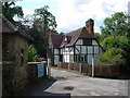
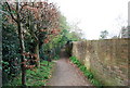
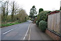
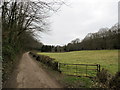
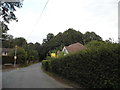
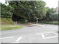
TN13 1PR represents a compact residential cluster within Sevenoaks, covering just 3.2 hectares. This small footprint supports a population of 1 693 people, creating a close-knit environment where neighbours often know one another. The area functions as a self-contained pocket of suburban life, offering a quiet routine away from the busier roads of the wider Sevenoaks town centre or Dunton Green. Living in TN13 1PR means prioritising peace and space over the vibrancy of a high street. The density stands at 991 people per square kilometre, which feels comfortable rather than congested for those who value a slower pace. You will find this postcode surrounded by greenery and established streets rather than bustling commercial strips. The housing here is primarily domestic stock, catering to families and professionals who seek stability. Your daily commute begins from a compact but well-defined locality that connects easily to nearby transport hubs. This area suits you if you prefer a predictable lifestyle centred on home life rather than nightlife or nightlife.
- Area Type
- Postcode
- Area Size
- 3.2 hectares
- Population
- 1693
- Population Density
- 991 people/km²
TN13 1PR functions as a mature owner-occupied market, defined by its high level of home ownership. With 86% of residents owning their homes, the area lacks the turnover of a rental-dominated district like near a university. You will find that the housing stock consists largely of houses, catering to families and professionals who value privacy and space. Buying a home here usually involves engaging with sellers who have been in their properties for years, leading to more negotiated transactions rather than bidding wars against multiple cash renters. The predominance of freehold or leasehold houses means that many buyers are looking for gardens, driveways, and larger interiors rather than compact flats. This profile supports a property market where value retention is strong due to the low demand and supply pressure in this specific postcode. If you are looking at homes in TN13 1PR, expect to compete with other local buyers who are not forced to move frequently for work. The lack of rental options means that once you find a suitable property, you are likely to stay for the long term.
House Prices in TN13 1PR
Showing 11 properties
| Address | Type | Beds | Baths | Last Sale Price | Last Sale Date | |
|---|---|---|---|---|---|---|
| Mulberry House, Oak Avenue, Sevenoaks, TN13 1PR | house | - | - | £3,700,000 | Jan 2024 | |
| Braeside, Oak Avenue, Sevenoaks, TN13 1PR | house | - | - | £2,700,000 | Jul 2022 | |
| Amberley House, Oak Avenue, Sevenoaks, TN13 1PR | Detached | 6 | 3 | £2,300,000 | Sep 2017 | |
| Combe Grove, Oak Avenue, Sevenoaks, TN13 1PR | Detached | 5 | 4 | £2,425,000 | Jul 2013 | |
| Lorne House, Oak Avenue, Sevenoaks, TN13 1PR | house | - | - | £2,000,000 | Aug 2009 | |
| Braddocks, Oak Avenue, Sevenoaks, TN13 1PR | house | - | - | £2,250,000 | Jul 2005 | |
| Ridge Lea, Oak Avenue, Sevenoaks, TN13 1PR | house | - | - | £1,650,000 | Jul 2002 | |
| Riftwood, Oak Avenue, Sevenoaks, TN13 1PR | Semi-detached | - | - | £775,000 | Nov 2001 | |
| Holmoak, Oak Avenue, Sevenoaks, TN13 1PR | Detached | 5 | 5 | - | - | |
| Lynwood, Oak Avenue, Sevenoaks, TN13 1PR | Detached | - | - | - | - |
Energy Efficiency in TN13 1PR
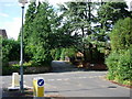
Residents of TN13 1PR enjoy convenient access to key amenities without needing to travel into central London. Five retail outlets operate in the immediate vicinity, including notable venues such as Waitrose Sevenoaks, Cook Sevenoaks, and Amazon Fresh. Waitrose Sevenoaks offers a wide range of fresh groceries, while Cook Sevenoaks provides additional supermarket choices for weekly shopping trips. Amazon Fresh brings last-minute delivery options to your doorstep, enhancing the convenience of daily food procurement. Beyond retail, the area serves as a transport hub with five nearby rail stations. Sevenoaks Railway Station is the primary node, but residents near Bat & Ball Railway Station and Dunton Green Railway Station also benefit from reduced journey times to Knockholt or Shepherd's Bush. This network allows you to maintain a suburban home while accessing the wider regional transport grid efficiently. Dining and leisure options cluster around these railway points, ensuring that evening outings do not require driving into town.
Amenities
Schools
Families raising children in TN13 1PR have access to specific educational institutions within practical reach. The New Beacon School stands as a notable nearby option and operates as an independent school. This presence provides a choice for parents seeking education models that differ from the state system, particularly regarding curriculum or teaching style. While this postcode lacks the sheer volume of state-maintained primary and secondary schools found in larger urban districts, the availability of an independent school indicates a willingness to invest in private education. You must note that no Ofsted ratings are provided in the current data, so your research should verify any recent inspection results before committing. The lack of other listed schools in the immediate vicinity means that families must look slightly further afield for comprehensive state education options. This mix suggests a community where education is a planned component of household budgeting rather than a default local assignment.
| Rank | School | Type | Entry gender | Ages |
|---|
Explore more schools in this area
Go to Schools tabDemographics
The community within TN13 1PR reflects a settled, older demographic living in stable homes. The median age sits at 47 years, indicating that the area is populated mainly by adults between the ages of 30 and 64. This age profile suggests a neighbourhood where children have often moved away, and residents are established in their careers or retirement planning. Home ownership is exceptionally high, with 86% of households owning their property outright or via mortgage. This statistic points to a community that has invested heavily in local real estate over many years and is not characterised by transient renting. Houses form the dominant accommodation type, reinforcing the suburban family appeal of the postcode. White residents make up the predominant ethnic group, contributing to a relatively homogenous social fabric. With such a high percentage of owner-occupied families, the area maintains a consistent character where long-term planning guides development decisions. You will encounter a neighbourly atmosphere built on shared interests and stability rather than the turnover common in student districts or city centres.
Household Size
Accommodation Type
Tenure
Ethnic Group
Religion
Household Composition
Age
Household Deprivation
NS-SEC
Explore more demographic insights in this area
Go to Demographics tabPlanning
Planning Constraints
- Flood RiskPremium
- Ramsar Wetland SitesPremium
- Area of Outstanding Natural BeautyPremium
- Protected Nature ReservePremium
- Protected WoodlandPremium