Area Overview for TN12 9DN
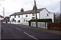
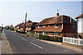
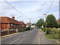
Photos of TN12 9DN


Area Information
TN12 9DN is a small residential cluster situated in the Upper Medway Valley, covering an area of 18.0 hectares. This compact community hosts a population of 1,835 residents, creating a tight-knit environment where neighbours are often within shouting distance. The density stands at 64 people per square kilometre, which offers a quieter pace compared to denser urban neighbours while remaining close enough to essential services. Living in TN12 9DN means you are part of a defined locality that balances suburban ease with rural charm. The area functions well within the broader TN12 postcode, providing a stable home base without the congestion of larger towns. Residents enjoy a sense of space that is rare in the Kent landscape today. This location serves as a practical haven for those seeking a balance between independence and connectivity. You find yourself in a setting where the community character is defined by its established nature rather than rapid development. The area acts as a quiet anchor for families and individuals looking for a place to settle down.
- Area Type
- Postcode
- Area Size
- 18.0 hectares
- Population
- 1835
- Population Density
- 64 people/km²
The housing market in TN12 9DN is distinctly characterised by permanent settlement rather than transient renting. With 80 per cent home ownership, the area is dominated by residents who have chosen this location for the long term. This statistic indicates that the majority of homes in the postcode are family houses designed for independent living. The accommodation type is overwhelmingly houses, meaning you will encounter traditional brick buildings and established gardens rather than purpose-built apartments. This high ownership rate creates a stable market environment for buyers considering homes in this specific cluster. The property stock is likely well-maintained given the owner-occupier base, reducing the risk of neglected properties found in rental-heavy areas. If you are looking to purchase, you are entering an established market where resale value often holds steady due to demand from similar homeowners. The lack of social housing or student rentals ensures that the local supply remains consistent. You are buying into a stock that reflects the needs of families and workers seeking a quiet place to live.
House Prices in TN12 9DN
Showing 1 properties
| Address | Type | Beds | Baths | Last Sale Price | Last Sale Date | |
|---|---|---|---|---|---|---|
| Duckies Cottage, Battle Lane, Marden, TN12 9DN | Detached | 4 | 1 | - | - |
Energy Efficiency in TN12 9DN
Daily life in TN12 9DN is convenient thanks to a cluster of practical amenities within practical reach. Residents have access to five railway stations, including Marden Railway Station, Staplehurst Railway Station, and Headcorn Railway Station. These transport hubs connect you to regional centres like London and Maidstone without requiring lengthy detours. For your daily shopping needs, there are five retail options available nearby. Sainsburys Staplehurst, Spar, and Morrisons Daily offer sufficient goods for weekly provisions, ensuring you rarely need to travel far for groceries. You can reload your fridge and pantry with minimal effort while supporting local business. The proximity of these shops, supermarkets, and train stations creates a self-contained lifestyle loop. You navigate your weekly routine with ease, balancing work, school runs, and shopping trips efficiently. This mix of transport and retail infrastructure defines the practical rhythm of day-to-day existence in this postcode.
Amenities
Schools
Families living in TN12 9DN have access to quality education within the Green Park school catchment. The nearest primary education is provided by Laddingford St Mary's Church of England Voluntary Controlled Primary School. This institution holds a 'Good' Ofsted rating, signifying a standard of education that meets the expectations of the UK government. For those seeking educational options for their children, this school represents a reliable choice within the immediate vicinity. There are no secondary schools listed in the immediate data for this specific postcode, which means pupils likely transfer to larger secondary institutions in the wider Medway or Tonbridge Bay Area. The presence of a good-rated primary school ensures that parents do not need to commute far for their children's early education. This specific school name and its rating provide a concrete benchmark for quality in TN12 9DN. Your children will attend an establishment that has been inspected and validated as successful in delivering a broad curriculum.
| Rank | School | Type | Entry gender | Ages |
|---|
Explore more schools in this area
Go to Schools tabDemographics
The demographic profile of TN12 9DN reflects a settled, mature community. Half of all households consist of adults aged between 30 and 64 years, with a median age of 47. This age range indicates a population that has stayed in the area for significant periods rather than moving through frequently. House ownership is exceptionally strong, with 80 per cent of residents owning their homes outright or with a mortgage. This high rate of ownership suggests deep roots in the community. Almost all accommodation in the area consists of houses, catering to families who require space and stability rather than the density of flats. The predominant ethnic group is White, mirroring the traditional character of many Upper Medway settlements. These figures combine to describe a stable, owner-occupied neighbourhood where residents are likely long-term inhabitants. You are living in an area where the people stay because they feel at home, contributing to a consistent local culture. The lack of a younger demographic or high turnover of renters points to a calm, predictable environment for your daily life.
Household Size
Accommodation Type
Tenure
Ethnic Group
Religion
Household Composition
Age
Household Deprivation
NS-SEC
Explore more demographic insights in this area
Go to Demographics tabPlanning
Planning Constraints
- Flood RiskPremium
- Ramsar Wetland SitesPremium
- Area of Outstanding Natural BeautyPremium
- Protected Nature ReservePremium
- Protected WoodlandPremium