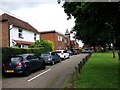
Area Overview for TN12 8LE
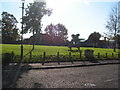
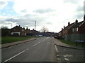
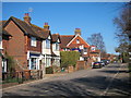
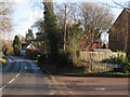
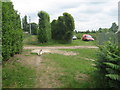
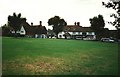
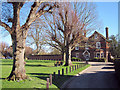
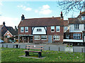
Photos of TN12 8LE


Area Information
West Malling's TN12 8LE postcode covers a compact residential cluster spanning just 2.7 hectares. This small area serves as a quiet pocket within the broader community, holding a population of 1,698 people. The low population density stands at 158 people per square kilometre, suggesting a calm environment where residential life dominates the landscape. Living in TN12 8LE means sharing space with a community that values seclusion alongside practical access to town services. The area functions as a distinct cluster rather than a sprawling neighbourhood, creating a tight-knit feel for anyone calling it home. Daily life here revolves around proximity to local centres while maintaining a residential atmosphere. Prospective buyers will find this location ideal for those seeking a retreat from busier street scenes. The specific boundaries of this postcode define a clear zone of housing dedicated primarily to settled families and individuals. You can expect a neighbourhood size that feels manageable, avoiding the congestion of larger urban districts. The layout supports a peaceful routine away from heavy traffic or high-density crowds.
- Area Type
- Postcode
- Area Size
- 2.7 hectares
- Population
- 1698
- Population Density
- 158 people/km²
Homes in TN12 8LE represent a steady market driven by owner-occupiers rather than investors or landlords. The data confirms that Houses define the entire accommodation type within this postcode. You will not find flats or converted apartments in this specific cluster. The overwhelming majority of residents are owners, as evidenced by the 71% home ownership figure. This statistic paints a picture of a stable market where people buy to stay, not to flip or rent out. Consequently, houses in this area tend to reflect the needs of families and mature adults seeking permanence. The single-source data on square footage or base prices remains absent, so you cannot assess specific valuations without external research. However, the concentration of owner-occupied dwellings suggests strong attachment to the location. Buyers looking for rental yields should look elsewhere, as the market is purely residential in nature. The uniform housing type means you deal in one product category when viewing properties here. This consistency offers clarity to those who know what they want in terms of house size and style.
House Prices in TN12 8LE
Showing 32 properties
| Address | Type | Beds | Baths | Last Sale Price | Last Sale Date | |
|---|---|---|---|---|---|---|
| 11 Oast View, Horsmonden, Tonbridge, TN12 8LE | house | - | - | £412,500 | Nov 2025 | |
| 14 Oast View, Horsmonden, Tonbridge, TN12 8LE | Detached | 5 | 2 | £555,000 | May 2023 | |
| 29 Oast View, Horsmonden, Tonbridge, TN12 8LE | Terraced | 3 | 1 | £355,000 | Jul 2021 | |
| 31 Oast View, Horsmonden, Tonbridge, TN12 8LE | Terraced | 4 | 2 | £379,950 | Dec 2019 | |
| 30 Oast View, Horsmonden, Tonbridge, TN12 8LE | Terraced | 3 | 1 | £310,000 | Feb 2019 | |
| 7 Oast View, Horsmonden, Tonbridge, TN12 8LE | Detached | 4 | 1 | £467,500 | Jan 2017 | |
| 1 Oast View, Horsmonden, Tonbridge, TN12 8LE | Detached | 4 | 2 | £427,000 | Aug 2016 | |
| 32 Oast View, Horsmonden, Tonbridge, TN12 8LE | house | - | - | £234,000 | Feb 2015 | |
| 19 Oast View, Horsmonden, Tonbridge, TN12 8LE | Terraced | 3 | 1 | £205,000 | May 2012 | |
| 27 Oast View, Horsmonden, Tonbridge, TN12 8LE | Terraced | 3 | 1 | £170,000 | Nov 2011 |
Energy Efficiency in TN12 8LE
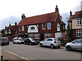
Residents of TN12 8LE benefit from a practical range of amenities within easy striking distance. The retail category offers five key locations, including Spar, Tesco Paddock, and Waitrose Paddock. These specific venues provide essentials from groceries to daily household goods without the need for a car. For rail travel, five stations lie nearby, offering links at Marden Railway Station, Paddock Wood Railway Station, and Beltring Railway Station. This network connection allows commuters to access major hubs beyond the local borough. The convenience of these specific shops means you can handle shopping trips locally. You do not need to venture miles out for basic necessities. The variety of stations ensures flexibility if one line is delayed or under maintenance. Daily life involves a mix of local convenience and regional accessibility. You can walk or drive quickly to Tesco or Waitrose for supplies. The transport links mean you can reach further afield for leisure or work. This balance of local self-sufficiency and regional connectivity defines the character of life in TN12 8LE.
Amenities
Schools
Families moving to TN12 8LE have two main educational options within practical reach. The closest primary education is provided by Horsmonden Primary School, which caters to younger children in the neighbourhood. For older students, Leigh Academy Horsmonden stands as a significant nearby option. This academy holds a good Ofsted rating, providing a reliable standard of education for secondary pupils. This combination of primary and secondary choices means families do not need to travel far for schooling. The presence of an academy suggests a modern curriculum while the primary school offers traditional local education. Neither school represents a state of uncertainty, as the rating confirms a quality institution. You can expect a straightforward commute to either facility for children living in this postcode. The mix ensures that as a child grows, they remain near their school until at least senior secondary levels. This matters for parents juggling work and childcare. The proximity reduces travel time and increases safety for students walking to and from classes.
| Rank | School | Type | Entry gender | Ages |
|---|
Explore more schools in this area
Go to Schools tabDemographics
The community within TN12 8LE skews significantly towards mature residents. Statistics show a median age of 47 years, confirming that Adults between 30 and 64 years old form the most common age range. This demographic profile indicates a neighbourhood populated by experienced homeowners rather than young professionals or families with very small children. Home ownership is the dominant housing tenure, with a striking 71% of residents owning their property outright or with a mortgage. This high level of ownership suggests long-term settlement and stability within the community. The accommodation type is exclusively Houses, which aligns perfectly with the older demographic profile and high ownership rate. The predominant ethnic group is White, reflecting the historical and current composition of the area. With 158 people per square kilometre, the density remains comfortable. You are unlikely to find mass transience or frequent tenant changes here. The community feels established, with people who have put down roots. The age distribution means the social fabric grows around longevity and established interests rather than rapid turnover.
Household Size
Accommodation Type
Tenure
Ethnic Group
Religion
Household Composition
Age
Household Deprivation
NS-SEC
Explore more demographic insights in this area
Go to Demographics tabPlanning
Planning Constraints
- Flood RiskPremium
- Ramsar Wetland SitesPremium
- Area of Outstanding Natural BeautyPremium
- Protected Nature ReservePremium
- Protected WoodlandPremium