Area Overview for TN12 7AT
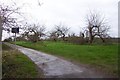
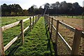
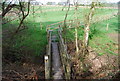
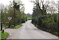
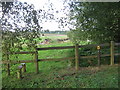
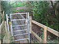
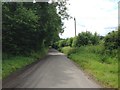
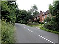
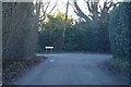
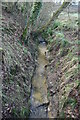
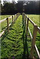
Photos of TN12 7AT

Area Information
TN12 7AT is a small, rural postcode nestled in the Borough of Tunbridge Wells, Kent, within the civil parish of Brenchley and Matfield. The area spans 44.5 hectares, with a population of 1,856 spread across a low-density settlement of 89 people per square kilometre. Its character is defined by historic woodlands, medieval routeways, and conservation areas, offering a quiet, countryside lifestyle. Located 8 miles east of Royal Tunbridge Wells and 3 miles south of Paddock Wood, it is accessible via the A21 and B2162 roads, linking residents to nearby towns. The parish includes villages like Brenchley and Matfield, with notable landmarks such as All Saints Church, a Grade 1 listed building dating to the 13th century, and the Old Palace, a half-timbered structure tied to local history. Daily life here is shaped by rural tranquillity, with a focus on historic preservation and community ties. The area’s proximity to Paddock Wood and Tunbridge Wells provides access to services while maintaining its distinct rural identity.
- Area Type
- Postcode
- Area Size
- 44.5 hectares
- Population
- 1856
- Population Density
- 89 people/km²
TN12 7AT is primarily an owner-occupied area, with 85% of homes owned by residents rather than rented. The accommodation type is predominantly houses, reflecting a rural, low-density housing stock. This contrasts with urban areas where flats or apartments dominate, and it suggests a focus on family homes and long-term residency. The small size of the postcode means the housing market is limited, with few properties available for purchase. Buyers should consider the surrounding areas for more options, as proximity to Paddock Wood and Tunbridge Wells offers additional property choices. The high home ownership rate and emphasis on houses indicate a community prioritising stability and space, though the limited supply may impact availability for new buyers.
House Prices in TN12 7AT
Showing 16 properties
| Address | Type | Beds | Baths | Last Sale Price | Last Sale Date | |
|---|---|---|---|---|---|---|
| Jubilee House, Horsmonden Road, Brenchley, Tonbridge, TN12 7AT | Detached | 4 | 3 | £1,210,000 | Nov 2023 | |
| The Old Cold Store, Horsmonden Road, Brenchley, Tonbridge, TN12 7AT | Detached | 5 | 4 | £1,395,000 | Apr 2023 | |
| 2, Burrs Hill Oast, Horsmonden Road, Brenchley, Tonbridge, TN12 7AT | Retail | 4 | 2 | £1,150,100 | Apr 2022 | |
| Oast Meadow, Horsmonden Road, Brenchley, Tonbridge, TN12 7AT | Detached | 4 | 3 | £625,000 | Dec 2012 | |
| The Cart Lodge, Horsmonden Road, Brenchley, Tonbridge, TN12 7AT | Detached | - | - | £139,000 | Apr 1996 | |
| 1, Burrs Hill Cottages, Horsmonden Road, Brenchley, Tonbridge, TN12 7AT | Semi-detached | 3 | 1 | - | - | |
| 6, Burrs Hill Cottages, Horsmonden Road, Brenchley, Tonbridge, TN12 7AT | Semi-detached | 3 | 2 | - | - | |
| 1, Burrs Hill Oast, Horsmonden Road, Brenchley, Tonbridge, TN12 7AT | Semi-detached | 5 | 2 | - | - | |
| Burrs Hill Barn House, Horsmonden Road, Brenchley, Tonbridge, TN12 7AT | Semi-detached | 4 | 2 | - | - | |
| Burrs Hill Barn, Horsmonden Road, Brenchley, Tonbridge, TN12 7AT | Semi-detached | 4 | - | - | - |
Energy Efficiency in TN12 7AT
Living in TN12 7AT offers a blend of rural tranquillity and accessible amenities. Nearby retail options include M&S Blue Boys Tonbridge BP, Spar, and Tesco Paddock, providing essential shopping within reach. The area’s historic character is complemented by practical facilities, with rail stations like Paddock Wood offering links to London and other towns. The parish includes sites such as All Saints Church and the Old Palace, enriching the cultural landscape. While the area is small, its connection to Paddock Wood and Tunbridge Wells ensures access to broader services. The low population density and historic surroundings create a lifestyle centred on community, nature, and heritage, with daily life shaped by quiet countryside living and proximity to urban conveniences.
Amenities
Schools
| Rank | School | Type | Entry gender | Ages |
|---|
Explore more schools in this area
Go to Schools tabDemographics
The population of TN12 7AT is predominantly adults aged 30–64, with a median age of 47, reflecting a mature, stable community. Home ownership is high at 85%, with most properties being houses rather than flats or apartments. The predominant ethnic group is White, though specific diversity statistics are not provided. The low population density of 89 people per square kilometre suggests a spread-out, low-traffic environment. This demographic profile indicates a community focused on long-term residency, with limited reliance on rental housing. The age range implies a mix of working professionals and retirees, contributing to a balanced local economy. The absence of detailed data on deprivation or income levels means quality of life assessments are inferred from the area’s safety, amenities, and historic character.
Household Size
Accommodation Type
Tenure
Ethnic Group
Religion
Household Composition
Age
Household Deprivation
NS-SEC
Explore more demographic insights in this area
Go to Demographics tabPlanning
Planning Constraints
- Flood RiskPremium
- Ramsar Wetland SitesPremium
- Area of Outstanding Natural BeautyPremium
- Protected Nature ReservePremium
- Protected WoodlandPremium