Area Overview for TN12 7AA
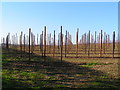
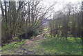
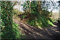
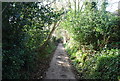
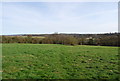
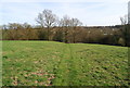
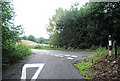
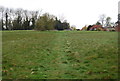
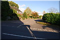
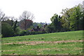
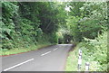
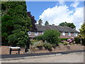
Photos of TN12 7AA
Area Information
TN12 7AA is a small, residential postcode area nestled in the rural heart of Kent, within the civil parish of Brenchley and Matfield. Covering 17.1 hectares, it is home to 1,856 people, giving it a population density of 89 people per square kilometre. The area is defined by its quiet, village-like character, with a median age of 47 and a strong presence of adults aged 30–64. This suggests a mature, stable community, many of whom likely own their homes—85% of residents do, with houses being the dominant type of accommodation. The area lies off the A21, near the B2162, just 3 miles south of Paddock Wood, offering access to nearby towns while retaining a rural feel. Historically, the parish has roots in medieval wood pasture and swine pastures, with landmarks like All Saints Church and the Old Palace adding to its heritage. Living here means a blend of countryside tranquillity and proximity to practical amenities, making it appealing to those seeking a peaceful yet connected lifestyle.
- Area Type
- Postcode
- Area Size
- 17.1 hectares
- Population
- 1856
- Population Density
- 89 people/km²
The property market in TN12 7AA is characterised by high home ownership—85% of residents own their homes—suggesting a strong preference for private, long-term residence over rental living. The area is dominated by houses rather than apartments or flats, aligning with its rural and semi-rural character. Given the small size of the postcode (17.1 hectares) and the population density of 89 people per square kilometre, the housing stock is likely limited to individual properties rather than large developments. This makes the area attractive to buyers seeking family homes with space, though the limited land area may restrict new builds. Proximity to Paddock Wood and the surrounding countryside adds to the appeal, offering a balance of seclusion and access to nearby amenities. For buyers, the market reflects a stable, owner-occupied community with a focus on traditional housing types.
House Prices in TN12 7AA
Showing 16 properties
| Address | Type | Beds | Baths | Last Sale Price | Last Sale Date | |
|---|---|---|---|---|---|---|
| 4 Church Close, Brenchley, Tonbridge, TN12 7AA | house | - | - | £468,000 | Oct 2019 | |
| 1 Church Close, Brenchley, Tonbridge, TN12 7AA | Terraced | 4 | 2 | £417,795 | Apr 2019 | |
| 3 Church Close, Brenchley, Tonbridge, TN12 7AA | Terraced | 3 | 1 | £385,000 | May 2016 | |
| 5 Church Close, Brenchley, Tonbridge, TN12 7AA | Detached | 4 | 2 | £600,000 | Sep 2013 | |
| 6 Church Close, Brenchley, Tonbridge, TN12 7AA | house | - | - | £757,500 | Feb 2010 | |
| 13 Church Close, Brenchley, Tonbridge, TN12 7AA | Detached | - | - | £632,500 | Sep 2008 | |
| 10 Church Close, Brenchley, Tonbridge, TN12 7AA | house | - | - | £675,000 | Jun 2008 | |
| 8 Church Close, Brenchley, Tonbridge, TN12 7AA | Detached | - | - | £682,000 | Sep 2006 | |
| 7 Church Close, Brenchley, Tonbridge, TN12 7AA | Detached | - | - | £200,000 | May 1996 | |
| 2 Church Close, Brenchley, Tonbridge, TN12 7AA | house | - | - | - | - |
Energy Efficiency in TN12 7AA
Residents of TN12 7AA have access to a mix of retail and transport amenities within practical reach. Nearby shops include Tesco Paddock, Waitrose Paddock, and M&S Blue Boys Tonbridge BP, providing everyday essentials and a range of retail options. The area is served by five nearby railway stations, including Paddock Wood, Beltring, and Marden, facilitating travel to larger towns and cities. While the postcode itself is rural, its proximity to the A21 and B2162 ensures easy access to surrounding villages and services. The character of daily life here is shaped by the village’s historic charm and natural surroundings, with the nearby Area of Outstanding Natural Beauty offering opportunities for walking and outdoor activities. The combination of local shops, transport links, and rural tranquillity supports a lifestyle that balances convenience with a peaceful environment.
Amenities
Schools
| Rank | School | Type | Entry gender | Ages |
|---|
Explore more schools in this area
Go to Schools tabDemographics
The population of TN12 7AA is predominantly adults aged 30–64, reflecting a mature demographic with a median age of 47. This age group suggests a community with established careers and families, likely contributing to the high home ownership rate of 85%. The area is overwhelmingly White in terms of ethnicity, indicating a relatively homogenous population. With 89 people per square kilometre, the density is low enough to maintain a village-like atmosphere but sufficient to support local services. The focus on owner-occupied homes and the prevalence of houses over flats or apartments suggest a preference for private, long-term living rather than rental properties. This demographic profile implies a stable, low-turnover community where residents are likely to have strong ties to the area and its historical and natural surroundings.
Household Size
Accommodation Type
Tenure
Ethnic Group
Religion
Household Composition
Age
Household Deprivation
NS-SEC
Explore more demographic insights in this area
Go to Demographics tabPlanning
Planning Constraints
- Flood RiskPremium
- Ramsar Wetland SitesPremium
- Area of Outstanding Natural BeautyPremium
- Protected Nature ReservePremium
- Protected WoodlandPremium