Area Overview for TN12 6PY
Photos of TN12 6PY
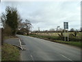

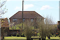
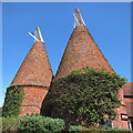


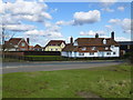

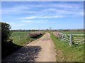
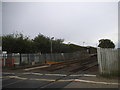
98 photos from this area
Area Information
Key information about the TN12 6PY including its size, population, and administrative classification.
- Area Type
- Postcode
- Area Size
- 59.7 hectares
- Population
- 1869
- Population Density
- 605 people/km²
House Prices in TN12 6PY
37
Properties
£568,500
Average Sold Price
£346,500
Lowest Price
£1,137,500
Highest Price
Showing 37 properties
| Address | Type | Beds | Baths | Last Sale Price | Last Sale Date | |
|---|---|---|---|---|---|---|
| Brookers Cottage, 338 Maidstone Road, Paddock Wood, Tonbridge, TN12 6PY | house | - | - | £400,000 | Jul 2022 | |
| Beltring Lodge, Maidstone Road, Paddock Wood, TN12 6PY | Bungalow | 2 | 1 | £390,000 | May 2022 | |
| Long Oast, Maidstone Road, Paddock Wood, TN12 6PY | Land | - | - | £1,137,500 | Apr 2020 | |
| The Coach House, Maidstone Road, Paddock Wood, TN12 6PY | Detached | 3 | - | £346,500 | Mar 2001 | |
| Beltring House, Maidstone Road, Paddock Wood, TN12 6PY | Detached | 5 | 3 | - | - | |
| BROOKERS OAST, MAIDSTONE ROAD, Paddock Wood, TN12 6PY | Maisonette | 1 | 1 | - | - | |
| Flat 2 Bell 7, The Hop Farm Country Park, Maidstone Road, Paddock Wood, Tonbridge, TN12 6PY | Flat | - | - | - | - | |
| Flat 1 Bell 7, The Hop Farm Country Park, Maidstone Road, Paddock Wood, Tonbridge, TN12 6PY | Flat | - | - | - | - | |
| Flat 3 Bell 7, The Hop Farm Country Park, Maidstone Road, Paddock Wood, Tonbridge, TN12 6PY | Flat | - | - | - | - | |
| Flat 4 Bell 7, The Hop Farm Country Park, Maidstone Road, Paddock Wood, Tonbridge, TN12 6PY | Flat | - | - | - | - |
Page 1 of 4
Energy Efficiency in TN12 6PY
Amenities
Schools
| Rank | School | Type | Entry gender | Ages |
|---|
Explore more schools in this area
Go to Schools tabDemographics
Household Size
Two person
most common
Accommodation Type
Houses
most common
Tenure
68
majority
Ethnic Group
White
most common
Religion
N/A
most common
Household Composition
N/A
most common
Age
47
median
Adults (30-64 years)
most common
Household Deprivation
N/A
with no deprivation
NS-SEC
32
in Lower managerial occupations
Explore more demographic insights in this area
Go to Demographics tabPlanning
Planning Constraints
- Flood RiskPremium
- Ramsar Wetland SitesPremium
- Area of Outstanding Natural BeautyPremium
- Protected Nature ReservePremium
- Protected WoodlandPremium