Area Overview for TN12 6GE
Photos of TN12 6GE
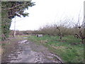
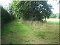
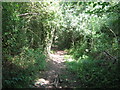
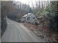

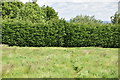
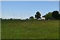


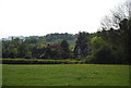
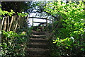
40 photos from this area
Area Information
Key information about the TN12 6GE including its size, population, and administrative classification.
- Area Type
- Postcode
- Area Size
- 6.4 hectares
- Population
- 1510
- Population Density
- 855 people/km²
House Prices in TN12 6GE
24
Properties
£570,603
Average Sold Price
£445,000
Lowest Price
£707,750
Highest Price
Showing 24 properties
| Address | Type | Beds | Baths | Last Sale Price | Last Sale Date | |
|---|---|---|---|---|---|---|
| 3 Omaha Grove, Paddock Wood, Tonbridge, TN12 6GE | house | - | - | £707,750 | Dec 2024 | |
| 18 Omaha Grove, Paddock Wood, Tonbridge, TN12 6GE | house | - | - | £457,000 | Apr 2024 | |
| 1 Omaha Grove, Paddock Wood, Tonbridge, TN12 6GE | Semi-detached | 4 | 3 | £587,050 | Mar 2024 | |
| 19 Omaha Grove, Paddock Wood, Tonbridge, TN12 6GE | house | - | - | £550,000 | Mar 2024 | |
| 4 Omaha Grove, Paddock Wood, Tonbridge, TN12 6GE | house | - | - | £681,100 | Feb 2024 | |
| 2 Omaha Grove, Paddock Wood, Tonbridge, TN12 6GE | house | - | - | £548,000 | Feb 2024 | |
| 21 Omaha Grove, Paddock Wood, Tonbridge, TN12 6GE | house | - | - | £578,398 | Feb 2024 | |
| 17 Omaha Grove, Paddock Wood, Tonbridge, TN12 6GE | house | - | - | £445,000 | Feb 2024 | |
| 15 Omaha Grove, Paddock Wood, Tonbridge, TN12 6GE | Terraced | 3 | 2 | £581,130 | Feb 2024 | |
| 20 Omaha Grove, Paddock Wood, Tonbridge, TN12 6GE | Detached | 3 | 2 | - | - |
Page 1 of 3
Energy Efficiency in TN12 6GE
Amenities
Schools
| Rank | School | Type | Entry gender | Ages |
|---|
Explore more schools in this area
Go to Schools tabDemographics
Household Size
Family (3-5 people)
most common
Accommodation Type
Houses
most common
Tenure
73
majority
Ethnic Group
White
most common
Religion
N/A
most common
Household Composition
N/A
most common
Age
47
median
Adults (30-64 years)
most common
Household Deprivation
N/A
with no deprivation
NS-SEC
41
in Lower managerial occupations
Explore more demographic insights in this area
Go to Demographics tabPlanning
Planning Constraints
- Flood RiskPremium
- Ramsar Wetland SitesPremium
- Area of Outstanding Natural BeautyPremium
- Protected Nature ReservePremium
- Protected WoodlandPremium