Area Overview for TN12 0DP
Photos of TN12 0DP

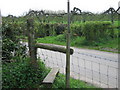
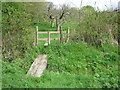
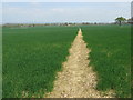
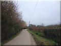

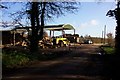
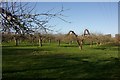
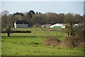
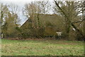
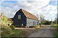

31 photos from this area
Area Information
Key information about the TN12 0DP including its size, population, and administrative classification.
- Area Type
- Postcode
- Area Size
- 1.6 km²
- Population
- 1831
- Population Density
- 176 people/km²
House Prices in TN12 0DP
21
Properties
£901,679
Average Sold Price
£548,750
Lowest Price
£1,190,000
Highest Price
Showing 21 properties
| Address | Type | Beds | Baths | Last Sale Price | Last Sale Date | |
|---|---|---|---|---|---|---|
| Chickenden Cottage, Chickenden Lane, Staplehurst, TN12 0DP | Cottage | 3 | 2 | £633,000 | May 2021 | |
| Chickenden Oast, Chickenden Lane, Staplehurst, TN12 0DP | house | - | - | £1,190,000 | Mar 2021 | |
| Kestrel Barn, Chickenden Lane, Staplehurst, TN12 0DP | house | - | - | £1,140,000 | Mar 2021 | |
| The Old Willow House, Chickenden Lane, Staplehurst, TN12 0DP | Detached | 4 | - | £548,750 | Feb 2018 | |
| Chickenden Barn, Chickenden Lane, Staplehurst, TN12 0DP | house | - | - | £1,000,000 | Sep 2017 | |
| Cottons Farm, Chickenden Lane, Staplehurst, TN12 0DP | Detached | - | - | £1,150,000 | Aug 2017 | |
| Spills Hill Barn, Chickenden Lane, Staplehurst, TN12 0DP | house | 4 | 4 | £650,000 | Aug 2009 | |
| Little Chickenden, Chickenden Lane, Staplehurst, TN12 0DP | Detached | 4 | - | - | - | |
| Longacres Farm, Cradducks Lane, Staplehurst, TN12 0DP | Farm | - | - | - | - | |
| Kingfishers, Chickenden Lane, Staplehurst, TN12 0DP | Bungalow | - | - | - | - |
Page 1 of 3
Energy Efficiency in TN12 0DP
Amenities
Schools
| Rank | School | Type | Entry gender | Ages |
|---|
Explore more schools in this area
Go to Schools tabDemographics
Household Size
Family (3-5 people)
most common
Accommodation Type
Houses
most common
Tenure
86
majority
Ethnic Group
White
most common
Religion
N/A
most common
Household Composition
N/A
most common
Age
47
median
Adults (30-64 years)
most common
Household Deprivation
N/A
with no deprivation
NS-SEC
42
in Lower managerial occupations
Explore more demographic insights in this area
Go to Demographics tabPlanning
Planning Constraints
- Flood RiskPremium
- Ramsar Wetland SitesPremium
- Area of Outstanding Natural BeautyPremium
- Protected Nature ReservePremium
- Protected WoodlandPremium