Area Overview for TN11 9SN
Photos of TN11 9SN
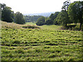
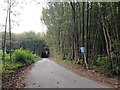
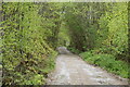
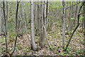
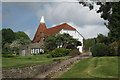

53 photos from this area
Area Information
Key information about the TN11 9SN including its size, population, and administrative classification.
- Area Type
- Postcode
- Area Size
- 98.3 hectares
- Population
- 1621
- Population Density
- 87 people/km²
House Prices in TN11 9SN
20
Properties
£992,646
Average Sold Price
£350,000
Lowest Price
£1,910,000
Highest Price
Showing 20 properties
| Address | Type | Beds | Baths | Last Sale Price | Last Sale Date | |
|---|---|---|---|---|---|---|
| Makefeyres, Roughway Lane, Roughway, Tonbridge, TN11 9SN | Detached | - | - | £1,910,000 | Aug 2021 | |
| The White Cottage, Roughway Lane, Roughway, Tonbridge, TN11 9SN | house | 3 | - | £1,040,000 | Feb 2016 | |
| Crouchers Cottage, Roughway Lane, Roughway, Tonbridge, TN11 9SN | house | - | - | £765,000 | Aug 2011 | |
| Weald Ridge, Roughway Lane, Roughway, Tonbridge, TN11 9SN | house | 4 | - | £1,300,000 | Feb 2010 | |
| Roughway Cottage, Roughway Lane, Roughway, Tonbridge, TN11 9SN | house | - | - | £590,873 | Dec 1997 | |
| Ivy Cottage, Roughway Lane, Roughway, Tonbridge, TN11 9SN | house | 3 | - | £350,000 | Aug 1997 | |
| Lower Roughway, Roughway Lane, Roughway, Tonbridge, TN11 9SN | Detached | 8 | 4 | - | - | |
| Halebank, Roughway Lane, Roughway, Tonbridge, TN11 9SN | Detached | 4 | 2 | - | - | |
| May Cottage, Roughway Lane, Roughway, Tonbridge, TN11 9SN | Detached | - | - | - | - | |
| Pickers Accomodation Rear Of Goldings, Roughway Farm, Roughway Lane, Roughway, Tonbridge, TN11 9SN | Unknown | - | - | - | - |
Page 1 of 2
Energy Efficiency in TN11 9SN
Amenities
Schools
| Rank | School | Type | Entry gender | Ages |
|---|
Explore more schools in this area
Go to Schools tabDemographics
Household Size
Family (3-5 people)
most common
Accommodation Type
Houses
most common
Tenure
76
majority
Ethnic Group
White
most common
Religion
N/A
most common
Household Composition
N/A
most common
Age
47
median
Adults (30-64 years)
most common
Household Deprivation
N/A
with no deprivation
NS-SEC
51
in Lower managerial occupations
Explore more demographic insights in this area
Go to Demographics tabPlanning
Planning Constraints
- Flood RiskPremium
- Ramsar Wetland SitesPremium
- Area of Outstanding Natural BeautyPremium
- Protected Nature ReservePremium
- Protected WoodlandPremium