Area Overview for TN11 9LR
Photos of TN11 9LR
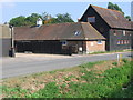
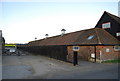


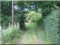
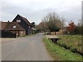
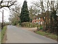
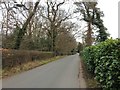
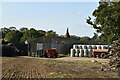
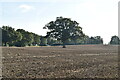
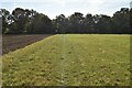
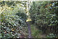
61 photos from this area
Area Information
Key information about the TN11 9LR including its size, population, and administrative classification.
- Area Type
- Postcode
- Area Size
- 21.4 hectares
- Population
- 1738
- Population Density
- 130 people/km²
House Prices in TN11 9LR
14
Properties
£802,364
Average Sold Price
£250,000
Lowest Price
£1,265,000
Highest Price
Showing 14 properties
| Address | Type | Beds | Baths | Last Sale Price | Last Sale Date | |
|---|---|---|---|---|---|---|
| Redwood, Riding Lane, Hildenborough, Tonbridge, TN11 9LR | Detached | 4 | - | £888,000 | Jun 2025 | |
| Braddan, Riding Lane, Hildenborough, Tonbridge, TN11 9LR | house | - | - | £1,265,000 | Nov 2020 | |
| Fieldview House, Riding Lane, Hildenborough, Tonbridge, TN11 9LR | Detached | 4 | 2 | £935,000 | Oct 2020 | |
| Woodhatch, Riding Lane, Hildenborough, Tonbridge, TN11 9LR | Detached | 5 | 4 | £1,030,000 | May 2020 | |
| Little Mount, Riding Lane, Hildenborough, Tonbridge, TN11 9LR | house | - | - | £1,210,000 | Mar 2019 | |
| Riding Oaks, Riding Lane, Hildenborough, Tonbridge, TN11 9LR | Bungalow | 4 | - | £860,000 | May 2012 | |
| Fair Haven, Riding Lane, Hildenborough, Tonbridge, TN11 9LR | Bungalow | 4 | - | £835,000 | Jul 2011 | |
| Riding Shaw, Riding Lane, Hildenborough, Tonbridge, TN11 9LR | Detached | - | - | £715,000 | Oct 2009 | |
| The Bend, Riding Lane, Hildenborough, Tonbridge, TN11 9LR | Detached | - | - | £498,000 | Sep 2005 | |
| Copleys, Riding Lane, Hildenborough, Tonbridge, TN11 9LR | Detached | - | - | £250,000 | Nov 2003 |
Page 1 of 2
Energy Efficiency in TN11 9LR
Amenities
Schools
| Rank | School | Type | Entry gender | Ages |
|---|
Explore more schools in this area
Go to Schools tabDemographics
Household Size
Family (3-5 people)
most common
Accommodation Type
Houses
most common
Tenure
83
majority
Ethnic Group
White
most common
Religion
N/A
most common
Household Composition
N/A
most common
Age
47
median
Adults (30-64 years)
most common
Household Deprivation
N/A
with no deprivation
NS-SEC
50
in Lower managerial occupations
Explore more demographic insights in this area
Go to Demographics tabPlanning
Planning Constraints
- Flood RiskPremium
- Ramsar Wetland SitesPremium
- Area of Outstanding Natural BeautyPremium
- Protected Nature ReservePremium
- Protected WoodlandPremium