Area Overview for TN11 9FB
Photos of TN11 9FB
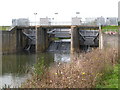

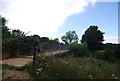
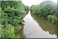
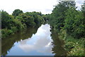
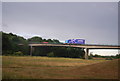
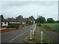
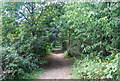
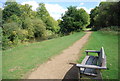
100 photos from this area
Area Information
Key information about the TN11 9FB including its size, population, and administrative classification.
- Area Type
- Postcode
- Area Size
- 6.7 hectares
- Population
- 2502
- Population Density
- 99 people/km²
House Prices in TN11 9FB
56
Properties
£595,767
Average Sold Price
£394,995
Lowest Price
£1,095,000
Highest Price
Showing 56 properties
| Address | Type | Beds | Baths | Last Sale Price | Last Sale Date | |
|---|---|---|---|---|---|---|
| 37 Burton Avenue, Leigh, TN11 9FB | Semi-detached | 5 | 2 | £725,000 | Nov 2025 | |
| 3 Burton Avenue, Leigh, TN11 9FB | Semi-detached | 3 | 2 | £560,000 | Oct 2024 | |
| 36 Burton Avenue, Leigh, TN11 9FB | Terraced | 2 | 2 | £420,000 | Oct 2024 | |
| 16 Burton Avenue, Leigh, TN11 9FB | Detached | 6 | 4 | £1,095,000 | Jul 2024 | |
| 56 Burton Avenue, Leigh, TN11 9FB | Terraced | 3 | 2 | £515,000 | Apr 2023 | |
| 26 Burton Avenue, Leigh, TN11 9FB | Semi-detached | 4 | 2 | £530,000 | Jun 2021 | |
| 11 Burton Avenue, Leigh, TN11 9FB | Semi-detached | 4 | 3 | £729,995 | May 2019 | |
| 15 Burton Avenue, Leigh, TN11 9FB | Detached | 5 | 2 | £600,000 | Apr 2018 | |
| 45 Burton Avenue, Leigh, TN11 9FB | house | - | - | £695,000 | Apr 2018 | |
| 39 Burton Avenue, Leigh, TN11 9FB | Semi-detached | 3 | 2 | £595,995 | Apr 2018 |
Page 1 of 6
Energy Efficiency in TN11 9FB
Amenities
Schools
| Rank | School | Type | Entry gender | Ages |
|---|
Explore more schools in this area
Go to Schools tabDemographics
Household Size
Family (3-5 people)
most common
Accommodation Type
Houses
most common
Tenure
69
majority
Ethnic Group
White
most common
Religion
N/A
most common
Household Composition
N/A
most common
Age
47
median
Adults (30-64 years)
most common
Household Deprivation
N/A
with no deprivation
NS-SEC
47
in Lower managerial occupations
Explore more demographic insights in this area
Go to Demographics tabPlanning
Planning Constraints
- Flood RiskPremium
- Ramsar Wetland SitesPremium
- Area of Outstanding Natural BeautyPremium
- Protected Nature ReservePremium
- Protected WoodlandPremium