Area Overview for TN11 9DB
Photos of TN11 9DB
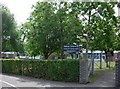
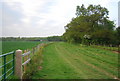
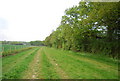
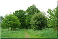

88 photos from this area
Area Information
Key information about the TN11 9DB including its size, population, and administrative classification.
- Area Type
- Postcode
- Area Size
- 14.4 hectares
- Population
- 1578
- Population Density
- 999 people/km²
House Prices in TN11 9DB
24
Properties
£426,423
Average Sold Price
£178,000
Lowest Price
£910,000
Highest Price
Showing 24 properties
| Address | Type | Beds | Baths | Last Sale Price | Last Sale Date | |
|---|---|---|---|---|---|---|
| 8 Hill View Road, Hildenborough, Tonbridge, TN11 9DB | Detached | 4 | 1 | £660,000 | Aug 2024 | |
| 21 Hill View Road, Hildenborough, Tonbridge, TN11 9DB | Semi-detached | 3 | 1 | £460,000 | Oct 2023 | |
| 23 Hill View Road, Hildenborough, Tonbridge, TN11 9DB | house | - | - | £462,000 | Mar 2022 | |
| 6 Hill View Road, Hildenborough, Tonbridge, TN11 9DB | house | - | - | £470,000 | Jan 2021 | |
| 1 Hill View Road, Hildenborough, Tonbridge, TN11 9DB | Semi-detached | 3 | 1 | £492,000 | Mar 2016 | |
| 2 Hill View Road, Hildenborough, Tonbridge, TN11 9DB | Detached | 4 | - | £495,000 | Mar 2014 | |
| 4 Hill View Road, Hildenborough, Tonbridge, TN11 9DB | house | 3 | 1 | £400,000 | Oct 2013 | |
| 19 Hill View Road, Hildenborough, Tonbridge, TN11 9DB | house | - | - | £291,000 | Sep 2009 | |
| 15 Hill View Road, Hildenborough, Tonbridge, TN11 9DB | house | - | - | £238,000 | Mar 2009 | |
| Latters Farmhouse, Hill View Road, Hildenborough, Tonbridge, TN11 9DB | Detached | - | - | £910,000 | Mar 2005 |
Page 1 of 3
Energy Efficiency in TN11 9DB
Amenities
Schools
| Rank | School | Type | Entry gender | Ages |
|---|
Explore more schools in this area
Go to Schools tabDemographics
Household Size
Family (3-5 people)
most common
Accommodation Type
Houses
most common
Tenure
83
majority
Ethnic Group
White
most common
Religion
N/A
most common
Household Composition
N/A
most common
Age
47
median
Adults (30-64 years)
most common
Household Deprivation
N/A
with no deprivation
NS-SEC
45
in Lower managerial occupations
Explore more demographic insights in this area
Go to Demographics tabPlanning
Planning Constraints
- Flood RiskPremium
- Ramsar Wetland SitesPremium
- Area of Outstanding Natural BeautyPremium
- Protected Nature ReservePremium
- Protected WoodlandPremium