Area Overview for TN11 9AB
Photos of TN11 9AB
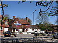
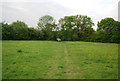
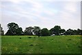
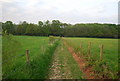
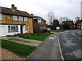
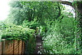
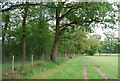
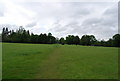

100 photos from this area
Area Information
Key information about the TN11 9AB including its size, population, and administrative classification.
- Area Type
- Postcode
- Area Size
- 2.7 hectares
- Population
- 1662
- Population Density
- 811 people/km²
House Prices in TN11 9AB
21
Properties
£462,607
Average Sold Price
£91,000
Lowest Price
£1,142,000
Highest Price
Showing 21 properties
| Address | Type | Beds | Baths | Last Sale Price | Last Sale Date | |
|---|---|---|---|---|---|---|
| 12 Leigh Road, Hildenborough, Tonbridge, TN11 9AB | Detached | 5 | 2 | £625,000 | Jun 2025 | |
| 30 Leigh Road, Hildenborough, Tonbridge, TN11 9AB | Semi-detached | 2 | 2 | £1,142,000 | Dec 2022 | |
| 4 Leigh Road, Hildenborough, Tonbridge, TN11 9AB | Semi-detached | 3 | 1 | £570,000 | May 2022 | |
| 20 Leigh Road, Hildenborough, Tonbridge, TN11 9AB | Bungalow | 4 | 2 | £710,000 | Jan 2022 | |
| 8 Leigh Road, Hildenborough, Tonbridge, TN11 9AB | house | - | - | £477,500 | Nov 2019 | |
| 24 Leigh Road, Hildenborough, Tonbridge, TN11 9AB | house | 4 | - | £608,000 | Aug 2019 | |
| 22 Leigh Road, Hildenborough, Tonbridge, TN11 9AB | house | - | - | £590,000 | Jul 2019 | |
| 16 Leigh Road, Hildenborough, Tonbridge, TN11 9AB | Semi-detached | 3 | 1 | £470,000 | Dec 2017 | |
| 36 Leigh Road, Hildenborough, Tonbridge, TN11 9AB | Semi-detached | - | - | £367,600 | Oct 2017 | |
| 14 Leigh Road, Hildenborough, Tonbridge, TN11 9AB | Semi-detached | - | - | £450,000 | Jan 2010 |
Page 1 of 3
Energy Efficiency in TN11 9AB
Amenities
Schools
| Rank | School | Type | Entry gender | Ages |
|---|
Explore more schools in this area
Go to Schools tabDemographics
Household Size
Family (3-5 people)
most common
Accommodation Type
Houses
most common
Tenure
91
majority
Ethnic Group
White
most common
Religion
N/A
most common
Household Composition
N/A
most common
Age
47
median
Adults (30-64 years)
most common
Household Deprivation
N/A
with no deprivation
NS-SEC
46
in Lower managerial occupations
Explore more demographic insights in this area
Go to Demographics tabPlanning
Planning Constraints
- Flood RiskPremium
- Ramsar Wetland SitesPremium
- Area of Outstanding Natural BeautyPremium
- Protected Nature ReservePremium
- Protected WoodlandPremium