Area Overview for TN11 0DT
Photos of TN11 0DT
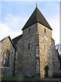
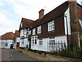
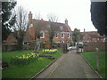
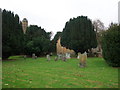
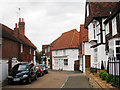
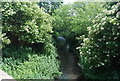
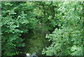
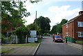
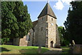
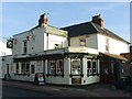
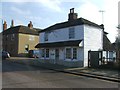
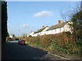
100 photos from this area
Area Information
Key information about the TN11 0DT including its size, population, and administrative classification.
- Area Type
- Postcode
- Area Size
- 8377 m²
- Population
- 1842
- Population Density
- 148 people/km²
House Prices in TN11 0DT
18
Properties
£333,532
Average Sold Price
£98,950
Lowest Price
£515,000
Highest Price
Showing 18 properties
| Address | Type | Beds | Baths | Last Sale Price | Last Sale Date | |
|---|---|---|---|---|---|---|
| 28 Appletons, Hadlow, Tonbridge, TN11 0DT | Semi-detached | 4 | 2 | £466,500 | Jan 2025 | |
| 13 Appletons, Hadlow, Tonbridge, TN11 0DT | house | - | - | £445,000 | Sep 2023 | |
| Macormicks Cottage, Appletons, Hadlow, Tonbridge, TN11 0DT | Semi-detached | 4 | 1 | £515,000 | Aug 2022 | |
| 18 Appletons, Hadlow, Tonbridge, TN11 0DT | house | - | - | £448,000 | Jan 2021 | |
| 16 Appletons, Hadlow, Tonbridge, TN11 0DT | house | - | - | £430,000 | Sep 2020 | |
| 14 Appletons, Hadlow, Tonbridge, TN11 0DT | house | - | - | £344,000 | Jun 2020 | |
| 30 Appletons, Hadlow, Tonbridge, TN11 0DT | Semi-detached | 3 | - | £307,000 | Mar 2015 | |
| 11 Appletons, Hadlow, Tonbridge, TN11 0DT | Semi-detached | 4 | - | £335,000 | Sep 2013 | |
| 3 Appletons, Hadlow, Tonbridge, TN11 0DT | house | - | - | £245,000 | Feb 2011 | |
| 20 Appletons, Hadlow, Tonbridge, TN11 0DT | house | - | - | £225,000 | Feb 2010 |
Page 1 of 2
Energy Efficiency in TN11 0DT
Amenities
Schools
| Rank | School | Type | Entry gender | Ages |
|---|
Explore more schools in this area
Go to Schools tabDemographics
Household Size
Two person
most common
Accommodation Type
Houses
most common
Tenure
84
majority
Ethnic Group
White
most common
Religion
N/A
most common
Household Composition
N/A
most common
Age
47
median
Adults (30-64 years)
most common
Household Deprivation
N/A
with no deprivation
NS-SEC
43
in Lower managerial occupations
Explore more demographic insights in this area
Go to Demographics tabPlanning
Planning Constraints
- Flood RiskPremium
- Ramsar Wetland SitesPremium
- Area of Outstanding Natural BeautyPremium
- Protected Nature ReservePremium
- Protected WoodlandPremium