Area Overview for TN10 4NG
Photos of TN10 4NG
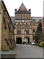
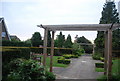
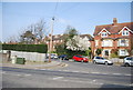
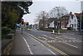
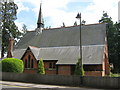
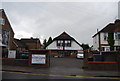
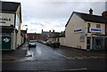
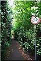
100 photos from this area
Area Information
Key information about the TN10 4NG including its size, population, and administrative classification.
- Area Type
- Postcode
- Area Size
- 2.8 hectares
- Population
- 1703
- Population Density
- 3577 people/km²
House Prices in TN10 4NG
79
Properties
£306,721
Average Sold Price
£94,250
Lowest Price
£567,500
Highest Price
Showing 79 properties
| Address | Type | Beds | Baths | Last Sale Price | Last Sale Date | |
|---|---|---|---|---|---|---|
| 39 Town Acres, Tonbridge, TN10 4NG | Semi-detached | 3 | 1 | £430,000 | Feb 2025 | |
| 47 Town Acres, Tonbridge, TN10 4NG | Detached | 4 | 1 | £500,000 | Jan 2023 | |
| 49 Town Acres, Tonbridge, TN10 4NG | Retail | 3 | 2 | £525,000 | Jul 2022 | |
| 66 Town Acres, Tonbridge, TN10 4NG | Semi-detached | 3 | 2 | £395,000 | Oct 2021 | |
| 27 Town Acres, Tonbridge, TN10 4NG | Detached | 3 | 1 | £440,000 | Sep 2021 | |
| 21 Town Acres, Tonbridge, TN10 4NG | Detached | 3 | 2 | £440,000 | Jan 2021 | |
| 69 Town Acres, Tonbridge, TN10 4NG | Detached | 4 | 2 | £490,000 | Dec 2020 | |
| 56 Town Acres, Tonbridge, TN10 4NG | Semi-detached | 3 | - | £350,000 | Jan 2020 | |
| 58 Town Acres, Tonbridge, TN10 4NG | Semi-detached | 3 | 1 | £350,000 | Dec 2019 | |
| 3 Town Acres, Tonbridge, TN10 4NG | house | - | - | £515,000 | Aug 2019 |
Page 1 of 8
Energy Efficiency in TN10 4NG
Amenities
Schools
| Rank | School | Type | Entry gender | Ages |
|---|
Explore more schools in this area
Go to Schools tabDemographics
Household Size
Family (3-5 people)
most common
Accommodation Type
Houses
most common
Tenure
61
majority
Ethnic Group
White
most common
Religion
N/A
most common
Household Composition
N/A
most common
Age
47
median
Adults (30-64 years)
most common
Household Deprivation
N/A
with no deprivation
NS-SEC
36
in Lower managerial occupations
Explore more demographic insights in this area
Go to Demographics tabPlanning
Planning Constraints
- Flood RiskPremium
- Ramsar Wetland SitesPremium
- Area of Outstanding Natural BeautyPremium
- Protected Nature ReservePremium
- Protected WoodlandPremium