Area Overview for TN10 4ND
Photos of TN10 4ND
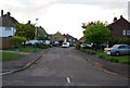
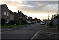
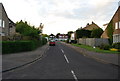
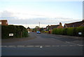
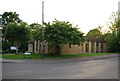
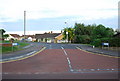
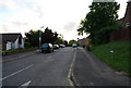
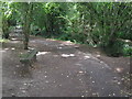
86 photos from this area
Area Information
Key information about the TN10 4ND including its size, population, and administrative classification.
- Area Type
- Postcode
- Area Size
- 1.6 hectares
- Population
- 1507
- Population Density
- 572 people/km²
House Prices in TN10 4ND
31
Properties
£372,454
Average Sold Price
£156,450
Lowest Price
£695,000
Highest Price
Showing 31 properties
| Address | Type | Beds | Baths | Last Sale Price | Last Sale Date | |
|---|---|---|---|---|---|---|
| 8 Greentrees Avenue, Tonbridge, TN10 4ND | Bungalow | - | - | £400,000 | Oct 2025 | |
| 32 Greentrees Avenue, Tonbridge, TN10 4ND | Semi-detached | 4 | 3 | £695,000 | Mar 2025 | |
| 2 Greentrees Avenue, Tonbridge, TN10 4ND | Semi-detached | 4 | 1 | £560,000 | Aug 2024 | |
| 16 Greentrees Avenue, Tonbridge, TN10 4ND | Semi-detached | 4 | 3 | £550,000 | Nov 2023 | |
| 9 Greentrees Avenue, Tonbridge, TN10 4ND | Bungalow | 3 | 1 | £457,000 | Sep 2023 | |
| 18 Greentrees Avenue, Tonbridge, TN10 4ND | Semi-detached | 2 | 1 | £450,000 | Sep 2023 | |
| 27 Greentrees Avenue, Tonbridge, TN10 4ND | Bungalow | 2 | 1 | £473,000 | Nov 2021 | |
| 11 Greentrees Avenue, Tonbridge, TN10 4ND | Semi-detached | 2 | 1 | £395,000 | Oct 2020 | |
| 21 Greentrees Avenue, Tonbridge, TN10 4ND | Bungalow | - | - | £370,000 | Mar 2020 | |
| 4 Greentrees Avenue, Tonbridge, TN10 4ND | Bungalow | - | - | £500,000 | May 2019 |
Page 1 of 4
Energy Efficiency in TN10 4ND
Amenities
Schools
| Rank | School | Type | Entry gender | Ages |
|---|
Explore more schools in this area
Go to Schools tabDemographics
Household Size
Two person
most common
Accommodation Type
Houses
most common
Tenure
92
majority
Ethnic Group
White
most common
Religion
N/A
most common
Household Composition
N/A
most common
Age
47
median
Adults (30-64 years)
most common
Household Deprivation
N/A
with no deprivation
NS-SEC
43
in Lower managerial occupations
Explore more demographic insights in this area
Go to Demographics tabPlanning
Planning Constraints
- Flood RiskPremium
- Ramsar Wetland SitesPremium
- Area of Outstanding Natural BeautyPremium
- Protected Nature ReservePremium
- Protected WoodlandPremium