Area Overview for TN10 4HS
Photos of TN10 4HS
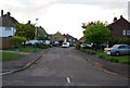
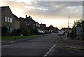
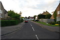
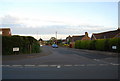
86 photos from this area
Area Information
Key information about the TN10 4HS including its size, population, and administrative classification.
- Area Type
- Postcode
- Area Size
- 2.1 hectares
- Population
- 1368
- Population Density
- 1315 people/km²
House Prices in TN10 4HS
45
Properties
£350,610
Average Sold Price
£62,500
Lowest Price
£750,000
Highest Price
Showing 45 properties
| Address | Type | Beds | Baths | Last Sale Price | Last Sale Date | |
|---|---|---|---|---|---|---|
| 38 Framley Road, Tonbridge, TN10 4HS | Semi-detached | 3 | 1 | £735,000 | Sep 2024 | |
| 23 Framley Road, Tonbridge, TN10 4HS | Semi-detached | 3 | 1 | £530,000 | Aug 2024 | |
| 11 Framley Road, Tonbridge, TN10 4HS | Semi-detached | 3 | 1 | £460,000 | Nov 2023 | |
| 27 Framley Road, Tonbridge, TN10 4HS | house | 4 | 2 | £750,000 | Jul 2023 | |
| 28 Framley Road, Tonbridge, TN10 4HS | house | 3 | 1 | £525,000 | Jul 2022 | |
| 46 Framley Road, Tonbridge, TN10 4HS | Semi-detached | 4 | 2 | £570,000 | May 2022 | |
| 14 Framley Road, Tonbridge, TN10 4HS | house | - | - | £485,000 | Mar 2022 | |
| 26 Framley Road, Tonbridge, TN10 4HS | house | - | - | £419,000 | May 2020 | |
| 13 Framley Road, Tonbridge, TN10 4HS | house | - | - | £335,000 | May 2020 | |
| 19 Framley Road, Tonbridge, TN10 4HS | Bungalow | - | - | £350,000 | May 2019 |
Page 1 of 5
Energy Efficiency in TN10 4HS
Amenities
Schools
| Rank | School | Type | Entry gender | Ages |
|---|
Explore more schools in this area
Go to Schools tabDemographics
Household Size
Family (3-5 people)
most common
Accommodation Type
Houses
most common
Tenure
93
majority
Ethnic Group
White
most common
Religion
N/A
most common
Household Composition
N/A
most common
Age
47
median
Adults (30-64 years)
most common
Household Deprivation
N/A
with no deprivation
NS-SEC
48
in Lower managerial occupations
Explore more demographic insights in this area
Go to Demographics tabPlanning
Planning Constraints
- Flood RiskPremium
- Ramsar Wetland SitesPremium
- Area of Outstanding Natural BeautyPremium
- Protected Nature ReservePremium
- Protected WoodlandPremium