Area Overview for TN10 4AD
Photos of TN10 4AD
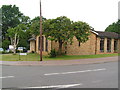
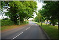
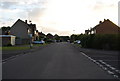
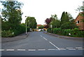
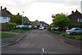
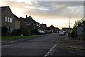
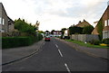
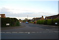
86 photos from this area
Area Information
Key information about the TN10 4AD including its size, population, and administrative classification.
- Area Type
- Postcode
- Area Size
- 1.2 hectares
- Population
- 1625
- Population Density
- 6537 people/km²
House Prices in TN10 4AD
32
Properties
£210,359
Average Sold Price
£42,750
Lowest Price
£430,000
Highest Price
Showing 32 properties
| Address | Type | Beds | Baths | Last Sale Price | Last Sale Date | |
|---|---|---|---|---|---|---|
| 39 Gainsborough Gardens, Tonbridge, TN10 4AD | Semi-detached | 3 | 2 | £430,000 | Oct 2022 | |
| 27 Gainsborough Gardens, Tonbridge, TN10 4AD | Semi-detached | 2 | 1 | £300,000 | Feb 2022 | |
| 35 Gainsborough Gardens, Tonbridge, TN10 4AD | house | - | - | £325,000 | Sep 2021 | |
| 11 Gainsborough Gardens, Tonbridge, TN10 4AD | house | - | - | £300,000 | Jul 2019 | |
| 13 Gainsborough Gardens, Tonbridge, TN10 4AD | Terraced | 3 | 1 | £240,000 | Aug 2016 | |
| 7 Gainsborough Gardens, Tonbridge, TN10 4AD | house | - | - | £51,250 | Apr 2011 | |
| 29 Gainsborough Gardens, Tonbridge, TN10 4AD | house | 2 | - | £188,000 | Dec 2010 | |
| 4 Gainsborough Gardens, Tonbridge, TN10 4AD | Semi-detached | - | - | £159,000 | May 2005 | |
| 41 Gainsborough Gardens, Tonbridge, TN10 4AD | Terraced | - | - | £169,950 | Mar 2004 | |
| 2 Gainsborough Gardens, Tonbridge, TN10 4AD | house | 2 | - | £108,000 | Oct 2001 |
Page 1 of 4
Energy Efficiency in TN10 4AD
Amenities
Schools
| Rank | School | Type | Entry gender | Ages |
|---|
Explore more schools in this area
Go to Schools tabDemographics
Household Size
Family (3-5 people)
most common
Accommodation Type
Houses
most common
Tenure
49
majority
Ethnic Group
White
most common
Religion
N/A
most common
Household Composition
N/A
most common
Age
47
median
Adults (30-64 years)
most common
Household Deprivation
N/A
with no deprivation
NS-SEC
25
in Lower managerial occupations
Explore more demographic insights in this area
Go to Demographics tabPlanning
Planning Constraints
- Flood RiskPremium
- Ramsar Wetland SitesPremium
- Area of Outstanding Natural BeautyPremium
- Protected Nature ReservePremium
- Protected WoodlandPremium