Area Overview for TN1 2JD
Photos of TN1 2JD

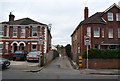
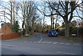
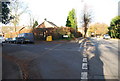
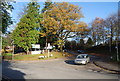
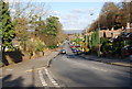
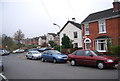
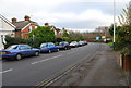
100 photos from this area
Area Information
Key information about the TN1 2JD including its size, population, and administrative classification.
- Area Type
- Postcode
- Area Size
- 1.2 hectares
- Population
- 2218
- Population Density
- 5474 people/km²
House Prices in TN1 2JD
32
Properties
£271,077
Average Sold Price
£18,750
Lowest Price
£420,000
Highest Price
Showing 32 properties
| Address | Type | Beds | Baths | Last Sale Price | Last Sale Date | |
|---|---|---|---|---|---|---|
| 35 Rochdale Road, Royal Tunbridge Wells, TN1 2JD | Terraced | 3 | 1 | £358,000 | Apr 2024 | |
| 9 Rochdale Road, Royal Tunbridge Wells, TN1 2JD | house | - | - | £310,000 | Aug 2022 | |
| 57 Rochdale Road, Royal Tunbridge Wells, TN1 2JD | Terraced | 2 | 1 | £373,500 | Oct 2021 | |
| 39 Rochdale Road, Royal Tunbridge Wells, TN1 2JD | Terraced | 2 | 1 | £367,500 | Aug 2021 | |
| 5 Rochdale Road, Royal Tunbridge Wells, TN1 2JD | Terraced | 2 | 1 | £291,000 | Jul 2021 | |
| 53 Rochdale Road, Royal Tunbridge Wells, TN1 2JD | Terraced | 2 | 1 | £325,000 | Mar 2021 | |
| 23 Rochdale Road, Royal Tunbridge Wells, TN1 2JD | house | 3 | - | £420,000 | Feb 2021 | |
| 43 Rochdale Road, Royal Tunbridge Wells, TN1 2JD | house | 2 | - | £342,500 | Jan 2021 | |
| 15 Rochdale Road, Royal Tunbridge Wells, TN1 2JD | house | - | - | £267,000 | Nov 2019 | |
| 17 Rochdale Road, Royal Tunbridge Wells, TN1 2JD | Terraced | 2 | 1 | £245,000 | Sep 2019 |
Page 1 of 4
Energy Efficiency in TN1 2JD
Amenities
Schools
| Rank | School | Type | Entry gender | Ages |
|---|
Explore more schools in this area
Go to Schools tabDemographics
Household Size
Family (3-5 people)
most common
Accommodation Type
Houses
most common
Tenure
60
majority
Ethnic Group
White
most common
Religion
N/A
most common
Household Composition
N/A
most common
Age
47
median
Adults (30-64 years)
most common
Household Deprivation
N/A
with no deprivation
NS-SEC
45
in Lower managerial occupations
Explore more demographic insights in this area
Go to Demographics tabPlanning
Planning Constraints
- Flood RiskPremium
- Ramsar Wetland SitesPremium
- Area of Outstanding Natural BeautyPremium
- Protected Nature ReservePremium
- Protected WoodlandPremium