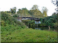
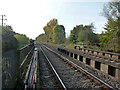
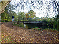
Area Overview for Tilehurst South & Holybrook Ward
Photos of Tilehurst South & Holybrook Ward
Area Information
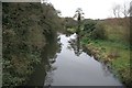
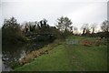
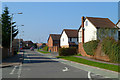
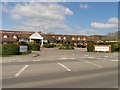
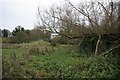
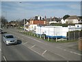
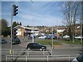
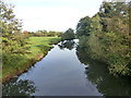
Tilehurst South & Holybrook Ward covers 2.9 square kilometres of land in Berkshire. It stands as a distinct district within the unitary authority structure of the local borough. Living in Tilehurst South & Holybrook Ward offers a defined residential space where daily life revolves around specific local boundaries. The area functions as a contained community with clear geographical limits. Prospective buyers looking for homes in Tilehurst South & Holybrook Ward find a compact environment rather than a sprawling town centre. This ward represents a specific slice of the wider Tilehurst region with its own demographic character. The physical size means access to local amenities is often immediate rather than dependent on long commutes. Residents navigate a neighbourhood where the distance to key services is measured in short drives or walks. You will find that the layout supports a self-contained lifestyle for those who prefer established quarters. The distinction between this ward and neighbouring areas creates a unique identity for those who choose to settle here. Understanding the scale of 2.9 km² helps you grasp the familiarity of streets and the proximity of local nodes. This ward is not a generic part of the city but a specific administrative unit with defined borders.
- Area Type
- District Borough Unitary Ward
- Area Size
- 2.9 km²
- Population
- Not available
- Population Density
- Not available
Demographics
The community in Tilehurst South & Holybrook Ward is defined by a median age of 70 years. This figure indicates that the population is significantly older than the national average. Most residents fall into the total age category as defined by local census records. Home ownership stands at 75 per cent of all households in this ward. Such a high percentage suggests that many people have lived in their properties for many years. The household composition data points to a settled population with stable living arrangements. Accommodation types within Tilehurst South & Holybrook Ward reflect this tenure status with a predominance of owner-occupied homes. Ethnic diversity figures are recorded as total within the dataset for this specific ward. Religious affiliations are similarly categorised under total for the area. These demographic traits create a quiet neighbourhood where life pace slows considerably compared to city centres. The age profile means you will likely encounter a community focused on retirement, gardening, and family visits from younger generations. Your daily interactions will likely involve neighbours who have known each other for decades. The high ownership rate stabilises the local economy and reduces transient movement through the streets.
Household Size
Accommodation Type
Tenure
Ethnic Group
Religion
Household Composition
Age
Household Deprivation
NS-SEC
Explore more demographic insights in this area
Go to Demographics tabPlanning
Planning Constraints
- Flood RiskPremium
- Ramsar Wetland SitesPremium
- Area of Outstanding Natural BeautyPremium
- Protected Nature ReservePremium
- Protected WoodlandPremium