Area Overview for Woking
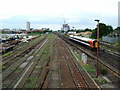
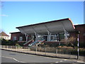
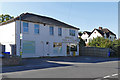
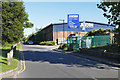
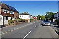
Photos of Woking


Area Information
Woking is a local authority district covering exactly 19.0 square kilometres in England. You will find 19,000 people living here, creating a population of 25,317 residents within a relatively compact footprint. The area sits at a population density of 1,335 people per square kilometre, which suggests a balanced mix of open space and developed neighbourhoods. Living in Woking means accessing a built environment that accommodates over 25,000,000 inhabitants across its defined borders without becoming overwhelmingly dense. This figure helps you understand the scale of daily life here, where civic amenities serve a specific and defined community rather than a vast, sprawling metropolis. As you explore homes in Woking, you are entering a district that functions as a distinct borough with its own governance and identity. The total population reflects a settlement type that is significant enough to support full local services yet small enough to maintain a manageable character. You do not face the anonymity of a megacity here; instead, you live amongst a defined group of neighbours within these specific boundaries. The physical size of the area ensures that infrastructure is not overstretched, allowing for a more consistent quality of service delivery. You can expect to navigate the district without the congestion typical of larger urban centres because the land area limits the total number of properties that can exist within view.
- Area Type
- Built Up Area 250
- Area Size
- 19.0 km²
- Population
- 25317
- Population Density
- 1335 people/km²
Amenities
Schools
| Rank | School | Type | Entry gender | Ages |
|---|
Explore more schools in this area
Go to Schools tabDemographics
Living in Woking means joining a community with a median age of 70 years. This specific figure indicates that the resident base skews considerably towards older demographics compared to the national average. You are looking at a settlement where the typical household consists largely of retired individuals or those who have remained in their homes for many decades. With a home ownership rate of 66%, you will encounter fewer tenants than you might expect in other parts of the country. This statistic confirms that the vast majority of people here have purchased their property and intend to stay. The community profile is defined by this high level of stability. When you consider homes in this borough, you are often dealing with buyers who have deep local roots. The accommodation stock reflects this history, as long-term ownership limits turnover and encourages maintenance. You will find that the prevailing sentiment is one of established residency rather than transient housing markets. While the data does not specify detailed breakdowns for ethnic groups or religious affiliations, the high ownership percentage suggests a settled population. This demographic reality shapes your experience; you will interact with neighbours who are likely to have lived in the area for a significant portion of their lives. The age profile further supports this, as medical facilities and leisure services tend to cater to an older audience, influencing the local economy.