Area Overview for Farnham
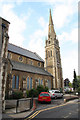
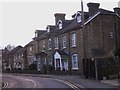
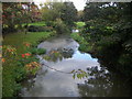
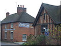
Photos of Farnham

Area Information
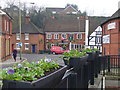
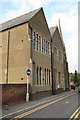
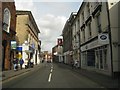
Farnham is an established civil parish situated in Surrey with a total area of 36.6 square kilometres. The settlement accommodates 24,687 residents, resulting in a population density of 675 people per square kilometre. This figure indicates a moderately populated neighbourhood that avoids the overcrowding found in major urban centres while retaining a concentration of households typical of suburban England. Life in Farnham offers a settled pace characterised by stable communities and a clear sense of locality. You will find a residential environment where daily routines are shaped by local amenities rather than reliance on distant city centres. The parish boundaries define a specific living space where homes sit within a structured grid of settlements and green spaces. Prospective buyers considering Farnham should expect a consistent community fabric maintained over many years. The location balances rural openness with the convenience of nearby services, making it suitable for families and retirees alike. You live here with the certainty that the area provides a designated space for dwelling and leisure without the chaos of high-density city living. The civil parish designation ensures local governance is tailored to the specific needs of these 24,000+ residents. Your view of Farnham includes areas of woodland and open land that contribute to the parish character. This setting supports a lifestyle where the natural environment plays a visible role in daily life.
- Area Type
- Parish
- Area Size
- 36.6 km²
- Population
- 24687
- Population Density
- 675 people/km²
Demographics
The community in Farnham is defined by a distinct age profile, with a median age of 70 years. This statistic places the settlement significantly above the national average and signals that the majority of residents are elderly. The demographic data confirms that the population consists principally of older adults rather than young families or working-age groups. With a home ownership rate of 84 per cent, nearly nine out of ten households in Farnham own their property outright or with a mortgage. This high level of ownership reflects long-term settlement patterns where many residents have lived in the same homes for decades. The household composition aligns with this older demographic, suggesting fewer multi-generational or large family units compared to other regions. The area does not exhibit high population density fluctuation, indicating a stable residential stock. You will encounter a neighbourhood where traditions and established social networks dominate the social landscape. The absence of young families in the data suggests limited school-age demand within the immediate parish limits. Instead, the community revolves around services and amenities catering to older residents. This demographic reality shapes the local economy and the types of businesses that thrive in Farnham. Your experience of living here involves engaging with a mature population that values stability and established routines.
Household Size
Accommodation Type
Tenure
Ethnic Group
Religion
Household Composition
Age
Household Deprivation
NS-SEC
Explore more demographic insights in this area
Go to Demographics tabPlanning
Planning Constraints
- Flood RiskPremium
- Ramsar Wetland SitesPremium
- Area of Outstanding Natural BeautyPremium
- Protected Nature ReservePremium
- Protected WoodlandPremium