Area Overview for Nutfield
Photos of Nutfield
Area Information
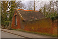
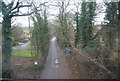
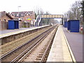
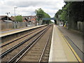
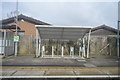
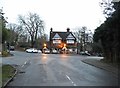
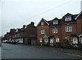
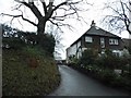
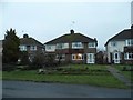
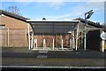
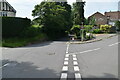
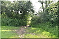
Nutfield is a civil parish situated in the Tandridge District of Surrey, located in the Weald immediately south of the Greensand Ridge. The area covers a total size of 10.7 km² and is defined by a predominantly rural and semi-rural setting. You will find yourself surrounded by agricultural green belt land, wetlands, and villages that retain a historic feel. The parish encompasses the larger neighbourhood of South Nutfield, which has grown significantly from the original village while maintaining a peaceful, countryside atmosphere. Metropolitan Green Belt policies actively protect this environment, ensuring that Nutfield Marshes and Mercers Country Park remain intact for recreation. This location is characterised by its historic landmarks and quiet character rather than urban development. Key features include the Grade II* listed St Peter and St Paul's Church, which dates back to the early 13th century, and Nutfield Priory, constructed between 1872 and 1874. The area also hosts the historic Banks Manor, part of which was used as a brewery. For those who value a connection to history and nature, living in Nutfield offers easy access to these protected sites without the noise of a busy town centre. South Nutfield provides essential amenities, including a primary school, village hall, and public houses, creating a self-contained community feel. The locale sits near the A25 and is linked to the Redhill to Tonbridge Line via South Nutfield railway station, offering a direct route to Redhill for further connectivity to London.
- Area Type
- Parish
- Area Size
- 10.7 km²
- Population
- Not available
- Population Density
- Not available
Demographics
The community profile in Nutfield reveals a significant portion of the population is senior residents. The median age for the area is 70 years, indicating a demographic skews towards older age groups compared to the national average. While the data categorises age under 'Total', the high median age suggests a retirement-friendly environment where many households include residents well into their later years. This age profile often correlates with a lighter pace of life and a preference for settled, stable neighbourhoods over fast-paced urban centres. Home ownership is extremely common within the parish, with 79% of households owning their homes outright or with a mortgage. This high rate of ownership suggests a stable, long-term resident base rather than a transient population. Such stability often fosters a strong sense of community identity and local support networks. Because so many people live in their own properties, the area likely features a mix of traditional cottage styles and more modern builds suitable for the older demographic. There are no specific figures provided for household composition types or predominant ethnic groups in the available data; however, the high home ownership rate and older median age point towards a classic village community dynamic. Residents here likely appreciate the quiet, historic surroundings and the convenience of local amenities found within the parish boundaries. The environment supports those seeking a retirement destination or a quiet place to raise a family away from bustling city pressures.
Household Size
Accommodation Type
Tenure
Ethnic Group
Religion
Household Composition
Age
Household Deprivation
NS-SEC
Explore more demographic insights in this area
Go to Demographics tabPlanning
Planning Constraints
- Flood RiskPremium
- Ramsar Wetland SitesPremium
- Area of Outstanding Natural BeautyPremium
- Protected Nature ReservePremium
- Protected WoodlandPremium