Area Overview for Surrey Heath District (B)
Photos of Surrey Heath District (B)

Area Information
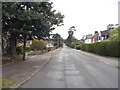
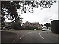
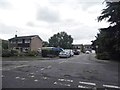
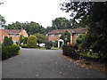
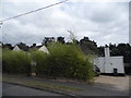
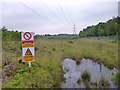
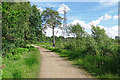
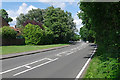
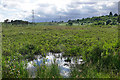
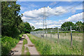
Surrey Heath District (B) is a local authority district located in north-western Surrey, covering an area of 95.1 square kilometres. You are entering a region defined by extensive heathland vegetation that grows on acidic sands and gravels. This distinctive landscape supports scrub and pine forest across common land. The borough was established on 1 April 1974 under the Local Government Act 1972 by merging Frimley and Camberley Urban District with Bagshot Rural District. While the area was sparsely populated and based on sterile Bagshot Sands until the 19th century, it now hosts around 80,000 to 86,000 residents. The name reflects the historic presence of Chobham Common and Bagshot Heath. Daily life here balances rural tranquility with suburban convenience. Administrative activities centre on Camberley, which serves as the district's administrative hub. Frimley offers similar suburban development alongside light industry. Much of the land remains dedicated to recreation or military use, a legacy of early significance dating back to George III reviewing troops at Wickham Bushes. You will find historic landmarks such as Waterer's nursery in Bagshot, which has operated for over 200 years. The district also contains former training camps for the Royal Military Academy Sandhurst at Camberley and Bisley Rifle Ranges. Living in Surrey Heath District (B) means accessing extensive commons and historic military sites without leaving the borough.
- Area Type
- District/Borough
- Area Size
- 95.1 km²
- Population
- Not available
- Population Density
- Not available
Demographics
The community profile reveals a mature population with a median age of 70 years. Research indicates this is an area consistently inhabited by older residents. The most common age range aligns with this senior demographic, suggesting a retirement-oriented or late-career settlement. Seven-fifths of the adult population, specifically 75%, own their homes outright or with a mortgage. This high ownership rate indicates long-term stability within the neighbourhoods. Household composition and accommodation type statistics confirm that traditional family housing and smaller independent living arrangements coexist. The predominant ethnic group and religious affiliation data point to a settled community structure typical of South East England. With such a high percentage of home ownership and an older median age, the social fabric likely revolves around established neighbourhood networks. There is little evidence of transient populations or high rental turnover. The low crime risk score of 74 out of 100 further suggests a secure environment. Residents benefit from a quiet setting where the majority hold titles to their properties. This demographic mix creates a stable, family-friendly and senior-centric atmosphere distinct from younger urban hubs.
Household Size
Accommodation Type
Tenure
Ethnic Group
Religion
Household Composition
Age
Household Deprivation
NS-SEC
Explore more demographic insights in this area
Go to Demographics tabPlanning
Planning Constraints
- Flood RiskPremium
- Ramsar Wetland SitesPremium
- Area of Outstanding Natural BeautyPremium
- Protected Nature ReservePremium
- Protected WoodlandPremium