Area Overview for Ash
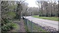
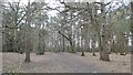
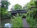
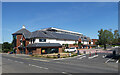
Photos of Ash


Area Information
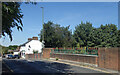
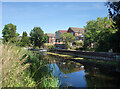
Living in Ash represents a shift from chaotic urban living to a settled parish lifestyle. This civil parish covers an area of just 9.7 km², making it a compact community where neighbours likely know one another. With a population standing at 4,865 residents, the area maintains a strong sense of local identity while offering enough space for quiet domestic life. The density here reaches 499 people per km², which reflects a moderately populated settlement typical of established English parishes rather than sprawling rural villages. You will find that daily life in Ash revolves around a mix of residential stability and accessible local amenities. The compact nature of the parish means that much of what you need is within a short walk or drive. This environment suits those who value proximity to their community without the constraints of high-rise living. The parish structure suggests a governance system focused on local interests, ensuring that the specific needs of these nearly 5,000 residents receive direct attention. Whether you are establishing a new home or considering a move, Ash offers a tangible, manageable footprint for family life. The boundaries are clear, and the community is defined by its shared space rather than by the subdivisions common in larger developments.
- Area Type
- Parish
- Area Size
- 9.7 km²
- Population
- 4865
- Population Density
- 499 people/km²
Demographics
The community profile of Ash reveals a distinctly mature neighbourhood. Your potential neighbours will likely include a significant cohort of retirees, with the median age recorded at 70 years. This demographic shift defines the social fabric of the parish, influencing everything from local shops to community events. Household composition in Ash mirrors this older population, resulting in a quiet, stable environment. Approximately 83% of residents own their homes outright or have a mortgage, indicating a deeply rooted population with a long-term connection to the locality. Home ownership stands as a major feature of life here, contrasting sharply with younger, transient urban markets. The high rate of proprietorship suggests that Ash is not a rental hub but a destination for those seeking permanence. Accommodation types will primarily consist of established homes suited to an older demographic, such as detached or semi-detached properties. This steady population structure means you will encounter fewerinstances of short-term tenancies. The area attracts individuals who have had time to build equity and stability. For families or younger buyers, the age profile may feel static, but it also guarantees low vacancy rates and a supportive, settled crowd. Living here guarantees interaction with a demographic that has already weathered life's storms.
Household Size
Accommodation Type
Tenure
Ethnic Group
Religion
Household Composition
Age
Household Deprivation
NS-SEC
Explore more demographic insights in this area
Go to Demographics tabPlanning
Planning Constraints
- Flood RiskPremium
- Ramsar Wetland SitesPremium
- Area of Outstanding Natural BeautyPremium
- Protected Nature ReservePremium
- Protected WoodlandPremium