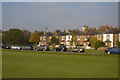
Area Overview for West Molesey
Photos of West Molesey


Area Information
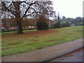
West Molesey is a compact built-up area in England, covering 11 square kilometres and home to 3,422 residents. Its population density of 311 people per square kilometre suggests a tightly knit community, though the median age of 70 indicates a predominantly older demographic. This is a place where daily life is shaped by proximity to amenities and a relatively low crime risk, with a safety score of 78 out of 100. The area’s charm lies in its accessibility to transport networks, including multiple railway stations and ferry landings, which connect residents to nearby towns like Esher and Hounslow. While the population is small, the presence of five primary schools, including Long Ditton Infant and Nursery School with an outstanding Ofsted rating, highlights a focus on education. For those considering living in West Molesey, the blend of practical connectivity, quiet residential character, and proximity to green spaces like Ditton Island makes it a viable option for those seeking a balanced lifestyle.
- Area Type
- Built Up Area 250
- Area Size
- 11.0 km²
- Population
- 3422
- Population Density
- 311 people/km²
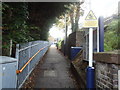
West Molesey’s lifestyle is shaped by its proximity to a range of amenities, from retail to transport. Local shops include Co-op Thames, Budgens High, and Budgens Manor, offering everyday essentials within walking distance. The area’s railway stations and ferry landings, such as Ditton Island and Moulsey, provide seamless access to nearby towns and leisure spots. While the data does not specify parks or recreational facilities, the presence of multiple transport options and retail hubs suggests a convenient, well-served environment. Residents can enjoy a mix of practicality and accessibility, with amenities tailored to both daily needs and occasional outings. The blend of retail, transport, and connectivity ensures that life in West Molesey balances simplicity with the comforts of a connected community.
Amenities
Schools
West Molesey is served by several primary schools, including The Orchard Infant School, which holds a good Ofsted rating, and Long Ditton Infant and Nursery School, rated outstanding. Thames Ditton Infant School also has a good rating, while Hinchley Wood Primary School and Thames Ditton Junior School lack specific Ofsted evaluations. The concentration of primary schools within the area provides families with multiple options, though the absence of secondary schools means students may need to travel to nearby towns for further education. The presence of high-performing schools like Long Ditton Infant and Nursery School could be a significant draw for families prioritising educational quality. However, the lack of detailed data on school capacity or catchment areas means prospective residents should verify admissions policies directly with the institutions.
| Rank | School | Type | Entry gender | Ages |
|---|
Explore more schools in this area
Go to Schools tabDemographics
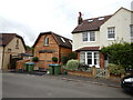
West Molesey’s population is overwhelmingly composed of individuals aged 70 and above, with the most common age range listed as “Age: Total,” suggesting a homogeneous demographic profile. Home ownership is high, with 75% of households owning their homes, indicating a stable residential base. The data does not specify household composition or accommodation types, but the overall population density of 311 people per square kilometre implies a mix of family units and single occupants. The lack of detailed diversity metrics means the area’s ethnic and religious composition remains unclear, though the absence of specific deprivation data suggests no immediate concerns about socioeconomic challenges. For residents, this demographic structure likely translates to a community with a strong emphasis on established living patterns, where property values and local services cater to long-term residents rather than transient populations.