Area Overview for Styants Bottom
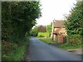
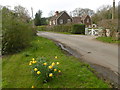
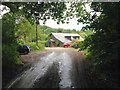
Photos of Styants Bottom


Area Information
Styants Bottom is a compact built-up area in England, spanning 24.6 hectares. It is a community defined by its older demographic, with a median age of 70, suggesting a population that may lean towards retirees or long-term residents. The area is home to 86% owner-occupiers, indicating a stable housing market with a strong emphasis on private property. Daily life here is shaped by proximity to key amenities: five railway stations, including Kemsing and Borough Green & Wrotham, offer reliable connections to nearby towns, while five retail outlets, such as Sainsburys Borough Green and Budgens Kemsing, provide essential shopping options. The area’s size is modest, but its infrastructure supports a practical lifestyle, balancing local convenience with access to broader networks. For those considering living in Styants Bottom, the combination of older demographics, strong home ownership, and accessible transport may appeal to those seeking a settled, low-maintenance environment.
- Area Type
- Built Up Area 250
- Area Size
- 24.6 hectares
- Population
- Not available
- Population Density
- Not available
Living in Styants Bottom offers access to a range of essential amenities within practical reach. The area’s five railway stations, including Kemsing and Borough Green & Wrotham, provide convenient transport links, while five retail outlets such as Sainsburys Borough Green and Budgens Kemsing ensure everyday shopping needs are met. For those who prefer local convenience, the proximity of these venues reduces the need for long commutes. The presence of multiple retail options also suggests a community that supports local commerce, which can contribute to a sense of place and continuity. While the data does not specify dining or leisure facilities, the availability of shops and transport hubs implies a practical, functional lifestyle. The area’s modest size means that residents can access these amenities without excessive travel, making it suitable for those prioritising convenience over sprawling urban environments.
Amenities
Schools
| Rank | A + A* % | School | Type | Entry gender | Ages |
|---|---|---|---|---|---|
| 1 | N/A | Apple Tree Cottage School | independent | N/A | N/A |
Explore more schools in this area
Go to Schools tabDemographics
The population of Styants Bottom has a median age of 70, with the most common age range encompassing the total population. This suggests a community where older residents predominate, potentially influencing local services and social dynamics. Home ownership is exceptionally high at 86%, indicating a lack of rental properties and a focus on long-term residency. The data does not specify household composition or accommodation types, but the overall figures imply a population that may be less transient and more family-oriented. While no specific information on ethnic diversity or religious composition is provided, the absence of detailed breakdowns means the community’s cultural and social fabric remains less defined in the data. For prospective buyers, the high home ownership rate and older demographic may signal a quiet, stable environment, though it also raises questions about the area’s appeal to younger families or professionals.