Area Overview for Stoughton
Photos of Stoughton

Area Information
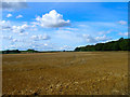
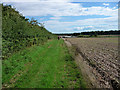
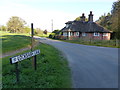
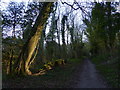
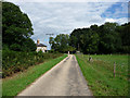
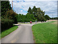
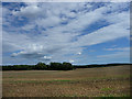
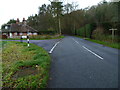
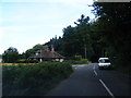
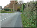
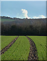
Stoughton is a distinct civil parish situated within Hampshire, covering a total area of 29.0 km². Living in Stoughton means embracing a location defined by its rural character and established communities. The parish functions as a self-contained neighbourhood where daily life typically revolves around local amenities rather than distant urban centres. You will find yourself in a setting where the built environment is interspersed with significant green spaces, including protected woodland areas. This spatial layout influences how residents move through the area, often favouring vehicle transport over walking for longer distances. The community feels rooted in its history, with a demographic profile that skews heavily towards older individuals. This age distribution shapes the local economy, social groups, and the types of services that thrive within the parish boundaries. There are no large commercial shopping districts immediately visible within the core of the village; instead, residents rely on specific local provisions. The area's distinct nature stems from its size and composition, offering a quieter alternative to nearby towns. When considering homes in Stoughton, you are purchasing into a territory where nature and established settlement patterns dominate the landscape. The 29 square kilometres provide ample room for habitation while maintaining a separation from the denser growth found further afield. Your experience here will be governed by these geographical facts and the community habits that have developed over decades.
- Area Type
- Parish
- Area Size
- 29.0 km²
- Population
- Not available
- Population Density
- Not available
Demographics
You should expect the community in Stoughton to reflect a significantly older population compared to the national average. Official data indicates a median age of 70 years, which defines the social fabric of the parish. This high median age means that young families with school-aged children represent a smaller proportion of the resident population than in many other areas. The total population structure confirms that the majority of households consist of older adults retired from their careers or downsizing from previous properties. Consequently, the energy of the local shops and clubs caters primarily to this demographic you will encounter regularly. Regarding household composition, the census records provide the aggregate total for the area without breaking down specific family or single-person statistics. This broad categorisation aligns with the overarching trend of an aging society residing within these boundaries. You will observe a stable community where long-term residents outnumber newcomers seeking to relocate for urban lifestyles. The low number of young adults correlates directly with the median age figure of 70. For those considering moving here, the social environment is one of quiet stability rather than the dynamic shifts seen in younger neighbourhoods. The age profile suggests a slower pace of life, which serves as both a benefit and a constraint depending on your personal needs. Understanding this demographic reality is essential before committing to life in Stoughton.
Household Size
Accommodation Type
Tenure
Ethnic Group
Religion
Household Composition
Age
Household Deprivation
NS-SEC
Explore more demographic insights in this area
Go to Demographics tabPlanning
Planning Constraints
- Flood RiskPremium
- Ramsar Wetland SitesPremium
- Area of Outstanding Natural BeautyPremium
- Protected Nature ReservePremium
- Protected WoodlandPremium