Area Overview for Steventon
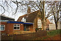
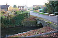
Photos of Steventon


Area Information
Sitting within a compact 1.1 km², Steventon is a small built-up area in England, characterised by its proximity to key transport links and local amenities. The area’s population, while not explicitly detailed, is reflected in its median age of 70, suggesting a community skewed towards older residents. This demographic profile shapes the rhythm of daily life, with a focus on accessibility to services and a quieter, more settled environment. Steventon is served by multiple railway stations, including Didcot Parkway and Appleford, offering straightforward connections to nearby towns. For those prioritising convenience, the area boasts a range of retail options, from the Co-op in Steventon to larger stores like Asda in Didcot. The presence of two primary schools, both named St Michael’s CofE Primary School, underscores the area’s appeal to families. Living in Steventon means balancing a tranquil setting with practical infrastructure, making it suitable for those seeking a low-maintenance lifestyle without sacrificing proximity to essential services.
- Area Type
- Built Up Area 250
- Area Size
- 1.1 km²
- Population
- Not available
- Population Density
- Not available
Sitting within a short distance of practical amenities, Steventon offers a mix of retail and transport options to support daily life. The Co-op in Steventon provides essential shopping, while larger stores like Asda in Didcot and M&S in Milton Heights Belfast BP cater to broader needs. For those reliant on public transport, the area’s four railway stations—including Didcot Parkway and Appleford—offer straightforward access to nearby towns and cities. While the data does not mention parks or leisure facilities, the presence of multiple retail outlets and rail links suggests a lifestyle focused on convenience and accessibility. The compact nature of the area means amenities are within walking or short driving distance, which is ideal for those preferring a low-maintenance routine. However, the absence of specific details on recreational spaces means the area’s character beyond shopping and transport remains less defined.
Amenities
Schools
Steventon is served by two primary schools, both named St Michael’s CofE Primary School, located in Steventon Village. These institutions cater to the area’s younger population, though no Ofsted ratings are provided in the data. The presence of two primary schools suggests a focus on early education, which is crucial for families with young children. However, the lack of secondary schools in the immediate vicinity may require families to consider commuting to nearby towns for further education. The duplication of the school name in the data could indicate either a naming oversight or a reflection of the community’s emphasis on local schooling. For families prioritising proximity to schools, the availability of two primary options is a clear advantage, but the absence of secondary education facilities means planning for long-term educational needs would need careful consideration.
| Rank | School | Type | Entry gender | Ages |
|---|
Explore more schools in this area
Go to Schools tabDemographics
Steventon’s population is predominantly older, with a median age of 70, indicating a community where retirees and long-term residents form the majority. The home ownership rate stands at 69%, suggesting that most properties are owner-occupied rather than rented. While specific data on household composition or ethnic diversity is not provided, the area’s demographics reflect a stable, established population. The lack of detailed breakdowns on accommodation types or deprivation levels means broader conclusions about the community’s socioeconomic profile remain limited. However, the high home ownership rate and median age imply a population with long-term ties to the area, likely prioritising security and familiarity over rapid change. For prospective buyers, this suggests a market shaped by older, potentially well-maintained properties, though the absence of more granular data means further research would be needed to fully assess the area’s diversity or challenges.
Household Size
Accommodation Type
Tenure
Ethnic Group
Religion
Household Composition
Age
Household Deprivation
NS-SEC
Explore more demographic insights in this area
Go to Demographics tabPlanning
Planning Constraints
- Crime RiskPremium