Area Overview for Stantonbury
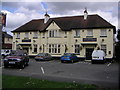
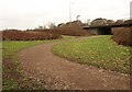
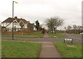
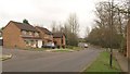
Photos of Stantonbury

Area Information
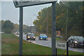
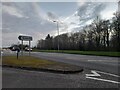
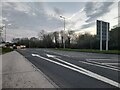
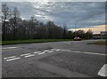
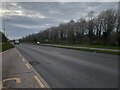
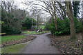
Living in Stantonbury involves residing within a compact civil parish covering just 4.6 square kilometres. This small geographical footprint defines a tightly knit environment where daily life revolves around immediate proximity to essential services. The area presents a clear distinction from larger urban sprawls due to its limited physical extent. You will find yourself in a location that demands reliance on local infrastructure rather than distant amenities. The setting feels established and settled, reflecting a community that has remained consistent over time. There are no grand projects reshaping the landscape; instead, the focus rests on maintaining the existing character of this eastern Hertfordshire settlement. Potential buyers seeking tranquility will appreciate the boundary your address imposes on the surrounding noise and traffic. The limited space means you cannot far in any direction before reaching the edge of the parish. This containment creates a sense of distinctness for anyone considering homes in Stantonbury. You are part of a specific, bounded community rather than a vast municipality. The lack of neighbouring villages within the parish itself reinforces the self-contained nature of daily life here. Your journey into the wider county begins just a short drive away. For those prioritising a clear separation between home and work, this parish offers a defined perimeter that you must work within.
- Area Type
- District Borough Unitary Ward
- Area Size
- 4.6 km²
- Population
- Not available
- Population Density
- Not available
Demographics
The community in Stantonbury is defined by an exceptionally elderly demographic profile. The median age reaches 70 years, indicating that half the population is significantly older than the national average. This age distribution suggests a neighbourhood where retirees and long-term residents form the core social fabric. You are likely to encounter an area populated by those who have called Stantonbury home for decades. The absence of a young median age influences the pace of life and the types of services that dominate local scenes. Household statistics reveal that 60 per cent of all properties in Stantonbury are owner-occupied. This high rate of ownership points to a settled community where residents have invested in their individual plots of land. The majority of homes are not rented out, creating a stable environment where neighbours tend to remain constant. There is little evidence of a transient population moving in and out frequently. This stability means that social networks are likely deeply rooted within the specific boundaries of the parish. If you are considering living in Stantonbury, expect to join a community where long-term residency is the norm rather than the exception. The demographic makeup strongly favours those seeking retirement living or permanent residence over temporary accommodation.
Household Size
Accommodation Type
Tenure
Ethnic Group
Religion
Household Composition
Age
Household Deprivation
NS-SEC
Explore more demographic insights in this area
Go to Demographics tabPlanning
Planning Constraints
- Flood RiskPremium
- Ramsar Wetland SitesPremium
- Area of Outstanding Natural BeautyPremium
- Protected Nature ReservePremium
- Protected WoodlandPremium
- Crime RiskPremium