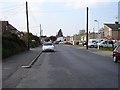
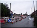
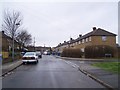
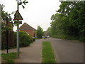
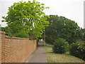
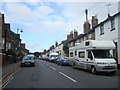
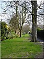
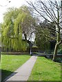
Area Overview for St. Ann's Ward
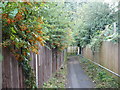
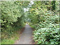
Photos of St. Ann's Ward


Area Information
St. Ann's Ward occupies a compact footprint of just 1.1 km² within the district, creating a highly concentrated living environment. This small size means daily journeys are short, yet the area maintains a distinct character defined by its exceptional level of home ownership. With 71% of residents owning their property, the ward feels firmly established as a settled community rather than a transient rental market. The average age of a resident here is 70, which suggests a quiet neighbourhood populated significantly by older adults enjoying their independence or retirement years. Life in St. Ann's Ward centres on stability and local connection, as evidenced by the high tenure rate among households. You will find a resident base that has put down roots, resulting in lower turnover and a sense of permanence. The limited land area ensures that everything from shops to community centres is within walking distance for most locals. This demographic skew toward older age groups combined with high ownership rates typically creates a peaceful atmosphere, though it also implies limited demographic diversity compared to larger districts. Anyone considering homes in this specific ward should anticipate a settled environment where neighbours know each other well, shaped by a population that has chosen to stay for the long term.
- Area Type
- District Borough Unitary Ward
- Area Size
- 1.1 km²
- Population
- Not available
- Population Density
- Not available
Demographics
The community profile of St. Ann's Ward reveals a population heavily weighted toward older residents. The median age stands at 70, making this one of the most aged wards in the surrounding region. This high figure indicates that the area attracts retirees or long-term residents who are in the later stages of life. While some data fields containing detailed breakdowns for specific sub-groups are not included in the current overview, the overarching age statistic clearly defines the social fabric. The high home ownership rate of 71% further reinforces this picture of a stable, older community. Approximately three out of every four households in St. Ann's Ward own their homes, suggesting that many residents have remained in the area for decades. This contrasts sharply with younger urban districts where rental shares are typically higher. The accumulation of older owners often leads to a slower pace of life and a different set of local priorities, such as access to healthcare, parks, and quiet streets. You are buying into an environment where the majority of your neighbours are likely to be in a similar age bracket. This demographic reality shapes the local shops and services to cater to established residents rather than young professionals or families with school-age children. Understanding this age profile is essential when imagining your daily life among people of similar generations who have built lifelong connections within these 1.1 km².
Household Size
Accommodation Type
Tenure
Ethnic Group
Religion
Household Composition
Age
Household Deprivation
NS-SEC
Explore more demographic insights in this area
Go to Demographics tabPlanning
Planning Constraints
- Flood RiskPremium
- Ramsar Wetland SitesPremium
- Area of Outstanding Natural BeautyPremium
- Protected Nature ReservePremium
- Protected WoodlandPremium
- Crime RiskPremium